|
Old Jockey Farm
Celia Denee and Alan Wadsworth Wiltshire Farmstead Project Photography Alan Wadsworth, unless stated otherwise August 2016 This article is an extract from the Wiltshire Farmsteads Project report on Old Jockey Farm: the Project aims to record the county's farm building heritage as part of the Wiltshire Buildings Record. It seeks to date farm buildings, define their structural evolution, assess the significance of architectural features and explain the history of farmstead buildings. |
Background
The data from the Wiltshire Farmsteads Mapping Project gives the following description for Jockey Farm, Box in 2016:
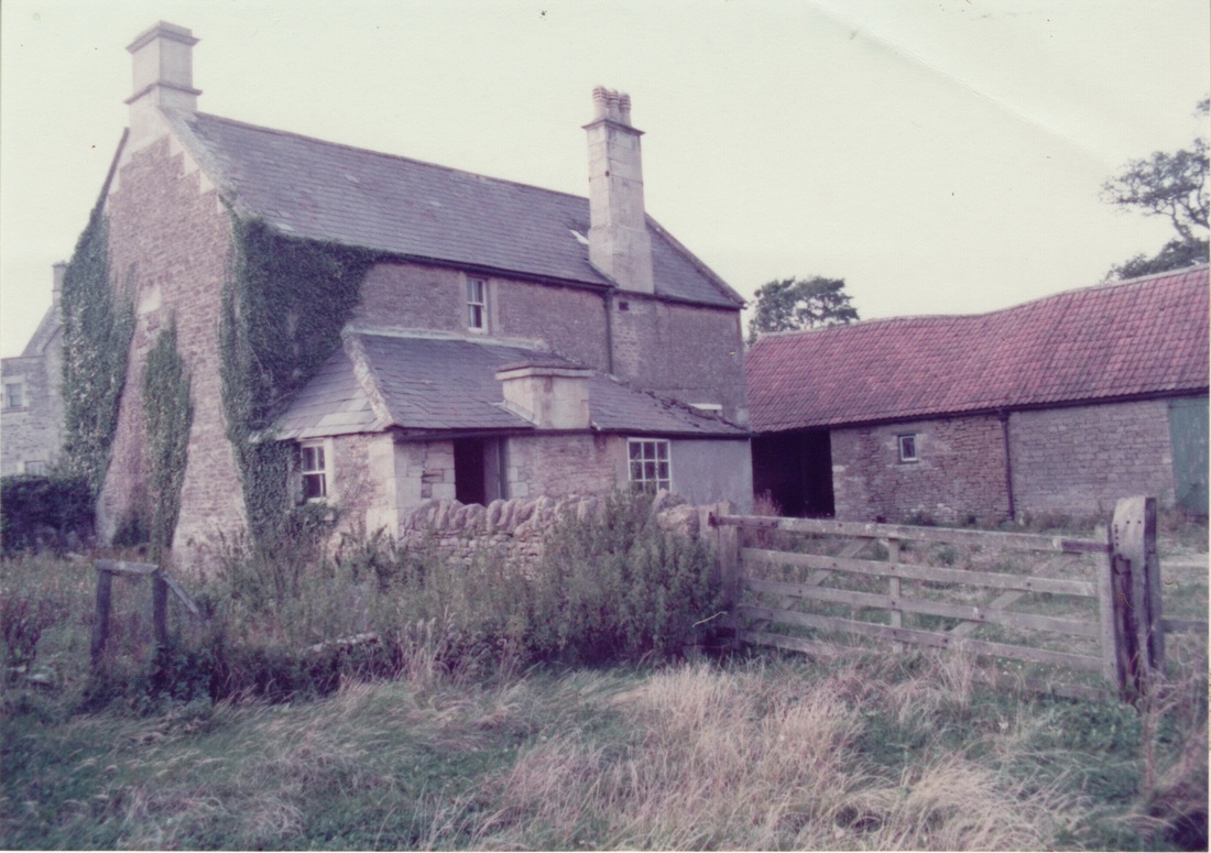
Partially extant 18th century farmstead of dispersed plan. The dispersed farm buildings are of clustered plan, isolated location. There has been partial loss (less than 50%) of traditional buildings. The farmstead comprises the farmhouse, along with three farm buildings: an old milking parlour, a combination barn and a roofless building. The buildings which have gone are asbestos pig sties, lean-to dairy and external water closet.
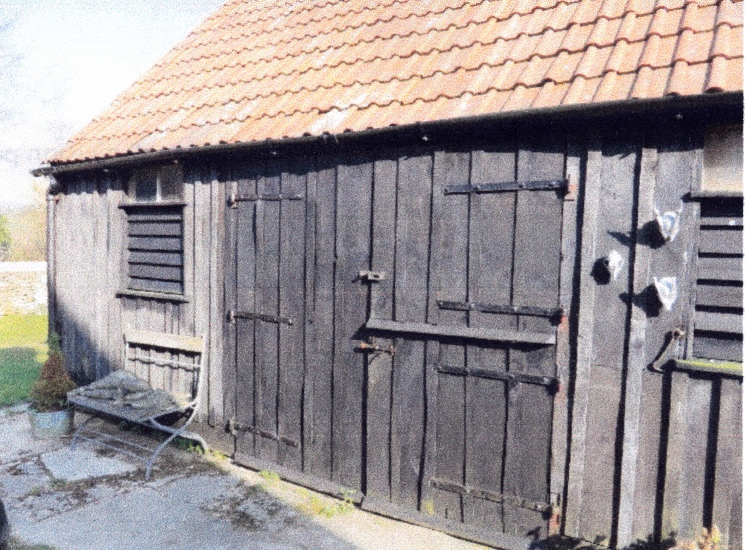
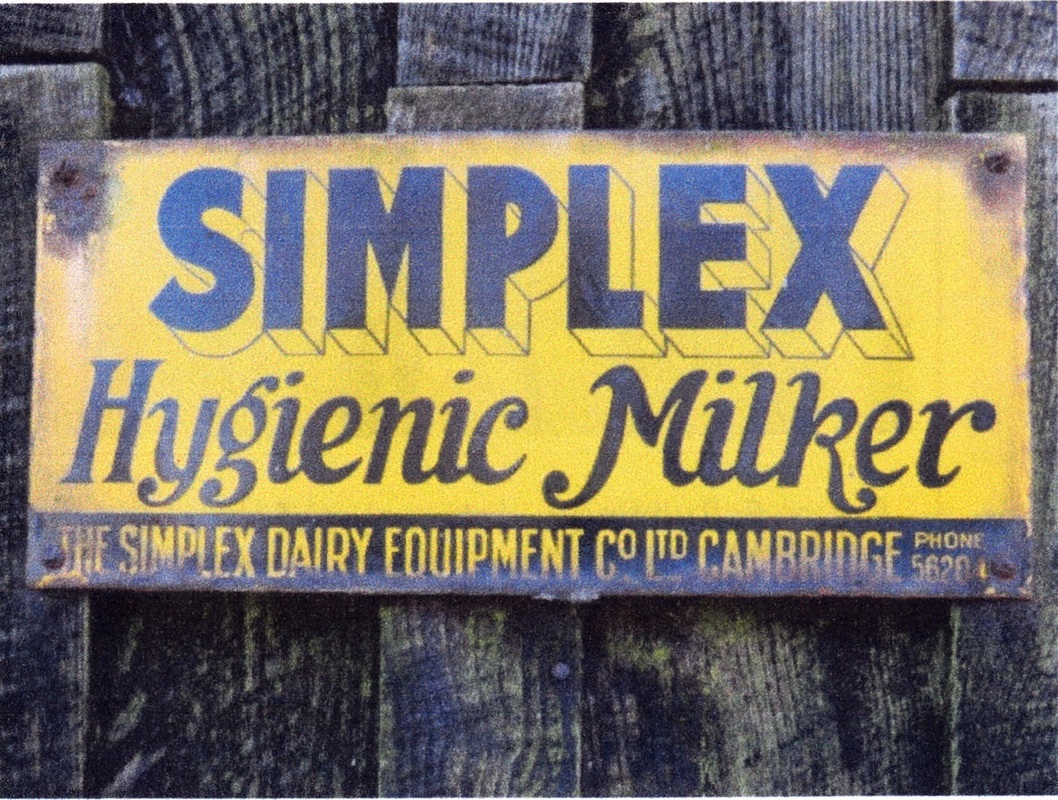
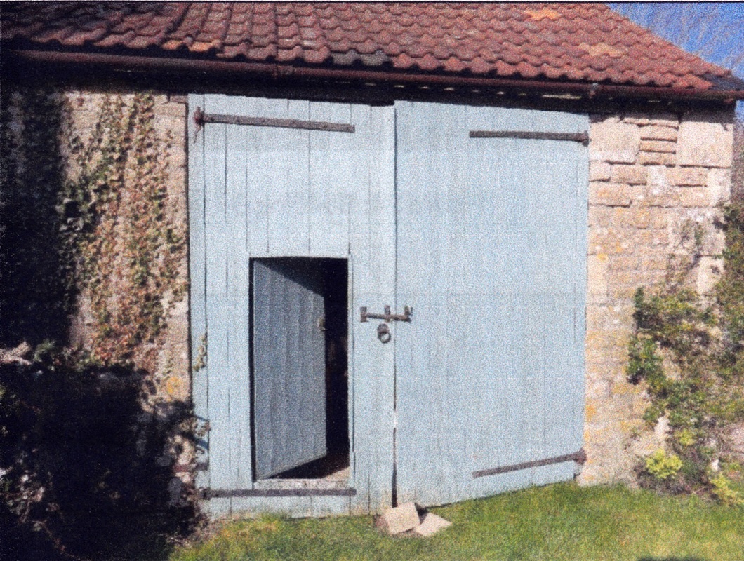
The old milking parlour is a timber-framed building possibly used as stable and milking parlour in the past (see below). It has three harness hooks, remains of timber stall divisions possibly with feeding passage and a Simplex milking parlour sign.[1]
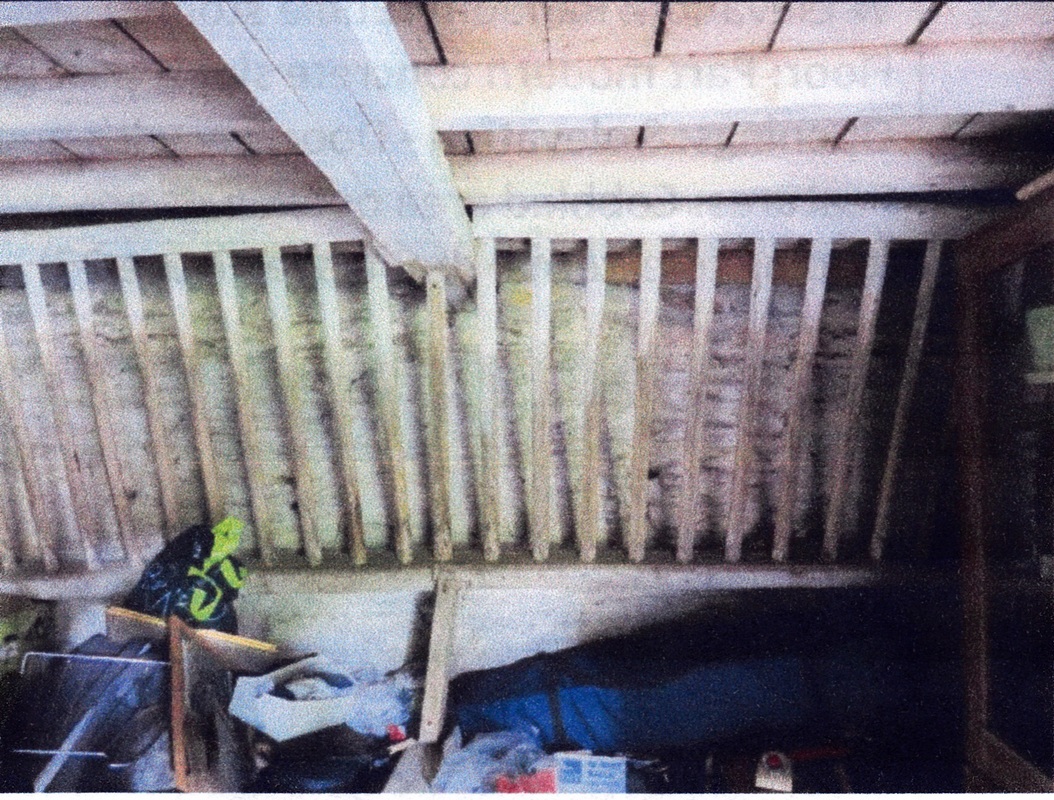
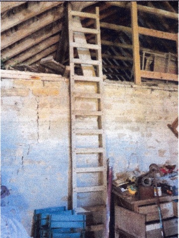
The combination barn (below) is a 4-bay stone-built building. From the open-fronted west end of the building, the remains of an upper stable door leads to the stable area evidenced by timber mangers with tie rings and timber hay racks above the mangers: the latter have blocked openings in the loft floor above which would have allowed direct delivery of hay from the loft to the hay racks below. This loft was accessed by a ladder on the east side of the stable.
History of The Old Jockey Hamlet
The small hamlet of The Old Jockey is in the parish of Box, approximately one mile to the south-east of Box village. The existence of Old Jockey Farm can be attributed to the neighbouring Old Jockey House, formerly the Horse and Jockey coaching inn, and factors affecting its immediate environs. Situated in an area previously known as Hatt, the reputation of the coaching inn gave the hamlet its name of The Old Jockey.
The small hamlet of The Old Jockey is in the parish of Box, approximately one mile to the south-east of Box village. The existence of Old Jockey Farm can be attributed to the neighbouring Old Jockey House, formerly the Horse and Jockey coaching inn, and factors affecting its immediate environs. Situated in an area previously known as Hatt, the reputation of the coaching inn gave the hamlet its name of The Old Jockey.
|
Old Jockey House is Grade II listed and has a construction date of 1737.[2] At that time, the main route to Bath went through Chapel Plaister, a place of rest for pilgrims going to Glastonbury, past the Horse and Jockey Inn, through the Blue Vein toll and over Kingsdown to Bathford and Bath.[3]
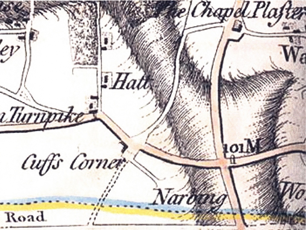
As Bath was the most fashionable town in England, this would have been a very busy route for coach services and the fine coaching inn was built alongside an existing alehouse.[4] Right: 1773 Andrews' & Dury's map of Wiltshire (redrawn 1810) shows the Old Jockey as "Cuffs Corner". Note also the approach to Hatt House is from the Drilley, a track from Blue Vein tollhouse, rather than the present drive off Short Hill. (Map courtesy Wilts History Centre) |
However, passing trade would have been significantly reduced when, in 1761, a new road was constructed and turnpiked under the Bricker's Barn Roads Trust which provided a better and more direct route to Bath along what is now the A4.[5] Andrews' and Dury's Map of Wiltshire dated 1773 shows some buildings where the inn was situated, on what was then called Cuffs Corner.
It still bears this name on the 1820 Greenwood Map, with an increased number of buildings.[6]
The Horse & Jockey Inn was sold in 1827 by Sir George Duckett Bt, for £250 to Mr Wm Hulbert, a common brewer of Pickwick.[7] In the same year, a plan was published showing a proposed route for a new road avoiding Kingsdown and the Horse & Jockey Inn. On an accompanying schedule, the numbered fields and property closest to the Horse and Jockey all belonged to John Fuller Esq.[8]
A new road was constructed around 1830 from the crossroads to the east of Old Jockey, now known as Box Fiveways, down into Box and joined the new Bath Road. Coupled with completion of the Box railway tunnel in 1841, which was the last section of the London to Bath Great Western Railway before it opened, the Horse & Jockey had ceased to be a popular coaching inn on a busy route and closed.[9] The property was now owned by John Fuller of nearby Neston Park who had purchased the buildings and
1½ acres of land from Mr Wm Hulbert in 1836.[10]
|
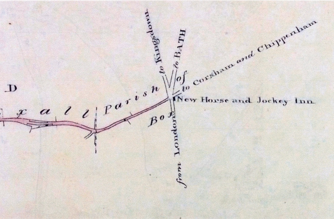
The Horse & Jockey Inn briefly re-opened in a new building at Fiveways, as can be evidenced on two maps, both dated 1840.
One is a plan of a proposed new turnpike road from Bradford-Leigh to Fiveways where the New Horse & Jockey is shown.[11] The new inn is also shown at Fiveways on the map prepared for the tithe awards.[12] However, the New Horse & Jockey Inn at Fiveways was never successful and closed after a short time.[13] Left: 1840 plan of proposed road (courtesy Wiltshire & Swindon Archive) |
The Box tithe apportionments were agreed in April 1838 and confirmed in December 1840. The written entry for reference number 730 on the map confirms that the property was no longer an inn as it is described as Dwellinghouse, outbuildings, cottages, barton and gardens. It comprised 1 acre, 1 rood and 39 perches. The occupier, Jacob Poulson, paid an annual rent charge of 5s.9d to the vicar. Reference number 671a was the New Horse and Jockey Inn, garden and stables occupied by George Gale. Both of these properties were owned by John Fuller as was reference number 665, Chappel Field, just over 23 acres of arable farmed by George Pinchin who also rented nearby Hatt House.[14]
In addition to the tithe map and the tithe apportionment or award, a separate tithe file was kept for each parish containing some additional information, not only on the procedures adopted in the commutation process, but also on farming practices in the local area. The tithe file for Box, Wiltshire contains a copy of the completed Form 58 which was used as part of the tithe commutation process to record key details about the land in each parish.[15] The tables below present the responses for Box parish.
In addition to the tithe map and the tithe apportionment or award, a separate tithe file was kept for each parish containing some additional information, not only on the procedures adopted in the commutation process, but also on farming practices in the local area. The tithe file for Box, Wiltshire contains a copy of the completed Form 58 which was used as part of the tithe commutation process to record key details about the land in each parish.[15] The tables below present the responses for Box parish.
|
| ||||||||||||
Smallholding Developed
During the latter half of the nineteenth century, a smallholding behind the old Horse & Jockey Inn gradually developed. The inn building was first let as a house to a farmer who later moved into a smaller property behind the old inn. This may have previously been an ostler's house, and the old inn stables were also put to use as farm buildings.
It is difficult to positively identify the first farmer who started the smallholding at Old Jockey. The first edition of Kelly's Directory to include Wiltshire in 1848 listed George Gale at the Horse & Jockey Inn; the tithe apportionment report suggests that this would have been the new inn at Fiveways. A George White was listed as a farmer at Horse & Jockey in the 1867 and 1875 editions of Kelly, but in the 1871 census his occupation was publican at Horse & Jockey.[16] In the 1880 edition of Kelly's, John Hall was at the Horse & Jockey, as he was in the 1881 census where his occupation is described as farmer. The house name on the census return is described as Late Horse and Jockey Inn.[17]
|
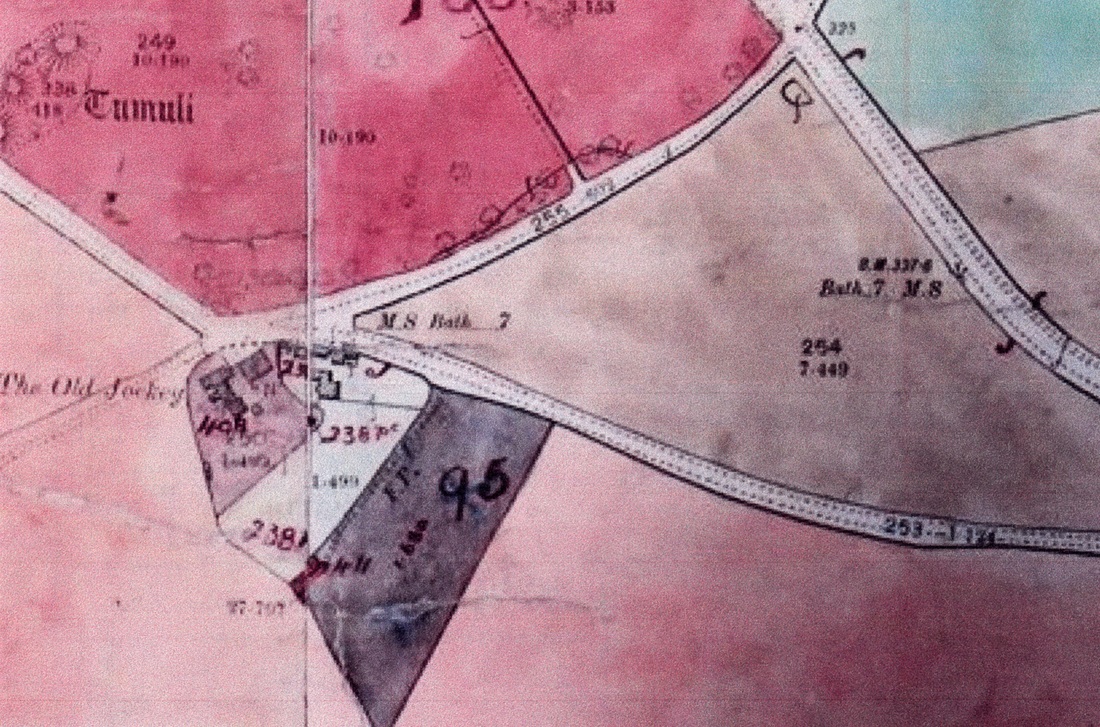
However, the Inland Revenue land valuation confirms that by 1910, the smallholding had been established and was occupied by Albert Clarke. Assessment number 238 was described as Land and Buildings situated near Chapel Field and Old Horse and Jockey.
The owner was GP Fuller and it was noted that his interest was copyhold. Albert Clarke had a yearly tenancy of a house, buildings and just over 19 acres for which he paid rent of £30: he also had right of pasture on Kingsdown Common. Expenditure of £60 was recorded on stable and pigsties. The gross value of the land and buildings was £10 and the rateable value £9.12s.0d: a tithe of £6.7s.9d was payable by the owner and the overall valuation calculation gave a gross value of £660.[18] |
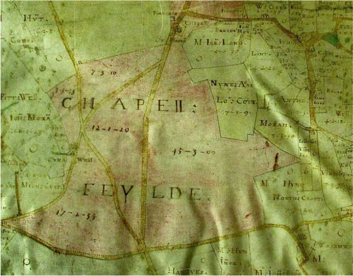
From the accompanying maps, it can be seen that for hereditament (land and building) number 238, there is some land adjacent to the farmhouse and buildings.[19] However, the bulk of the acreage is the distinctive triangular shaped Chapel Field to the north east, being the field owned by John Fuller at the time of the tithe awards and occupied by George Pinchin.[20] The history of this field can be traced further back to 1626: a watercolour map of Box parish shows some early enclosure and remaining common land with Chapell Feylde being one such enclosed and named field (see map below).[21]
George Pargiter Fuller had inherited Neston Park Estate, of which Old Jockey Farm was part, when his father John Bird Fuller died in 1872. He also inherited a share in the family brewery in Chiswick, was Chairman of the Avon Rubber Company in Melksham, High Sheriff of Wiltshire and a Liberal politician.[22] As a farmer, George Fuller embraced modern farming methods, including the purchase of one of the earliest steam-powered hay driers and the development of his own design of automatic stock feeder.[23]
George Pargiter Fuller had inherited Neston Park Estate, of which Old Jockey Farm was part, when his father John Bird Fuller died in 1872. He also inherited a share in the family brewery in Chiswick, was Chairman of the Avon Rubber Company in Melksham, High Sheriff of Wiltshire and a Liberal politician.[22] As a farmer, George Fuller embraced modern farming methods, including the purchase of one of the earliest steam-powered hay driers and the development of his own design of automatic stock feeder.[23]
Farmer Albert Clarke
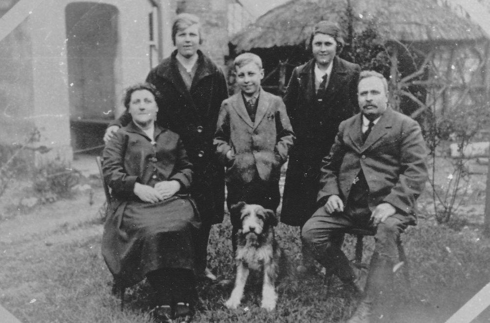
At the time of the 1911 census, Albert Clarke must have been away from the farm, as the head of the household was Mrs L Clarke, aged 29, a farmer's wife, married for 2 years and with a daughter, Dorothy, aged just over one year. Formerly Lily Garraway, Mrs Clarke came from Calne where she and Albert Clarke married in 1909.[24]
At the time of the 1911 census, Albert Clarke must have been away from the farm, as the head of the household was Mrs L Clarke, aged 29, a farmer's wife, married for 2 years and with a daughter, Dorothy, aged just over one year. Formerly Lily Garraway, Mrs Clarke came from Calne where she and Albert Clarke married in 1909.[24]
|
In her account of her childhood, living in part of what had been the Horse & Jockey ale-house, Katherine Harris tells that before the First World War, the Fullers enlarged the Old Jockey Farmhouse, made more fields available and built a dairy and new cowshed.
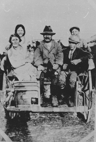
She describes the newly-wed Clarkes arriving at the farm with just one cow and Albert having to drive a post office mail cart to supplement their income. When the herd had increased sufficiently, this was replaced by a milk round doing deliveries twice a day to Box and the surrounding area. As well as selling milk, poultry and eggs, faggots made by Mrs Clarke were also on offer. |
After the corn had been cut by binder at harvest time, the men made sheaves, formed them into stooks to dry in the fields and then moved them to build ricks in the farmyard. A hired threshing machine going from farm to farm and pulled by a traction-engine visited Old Jockey Farm in the autumn and separated the grain from the straw, the grain being sold to a local miller.[25]
George Pargiter Fuller died in 1927. His eldest son, John Michael Fleetwood Fuller, had been created the first Baronet Fuller in 1910 but predeceased his father and the title was passed to his son, Sir John Gerard Henry Fleetwood Fuller. The ownership of the Neston estate passed to GP Fuller's second son, Lt Col William Fleetwood Fuller, who served in the Royal Wilts Yeomanry, was mentioned in despatches in the First World War and was awarded the DSO in 1918. He was unmarried.[26]
George Pargiter Fuller died in 1927. His eldest son, John Michael Fleetwood Fuller, had been created the first Baronet Fuller in 1910 but predeceased his father and the title was passed to his son, Sir John Gerard Henry Fleetwood Fuller. The ownership of the Neston estate passed to GP Fuller's second son, Lt Col William Fleetwood Fuller, who served in the Royal Wilts Yeomanry, was mentioned in despatches in the First World War and was awarded the DSO in 1918. He was unmarried.[26]
|
In April 1931, the Clarke family left Old Jockey Farm and moved to West Farm, Atworth, which was also part of the Fuller's Neston Park estate.[27] The outgoing valuation from Old Jockey Farm, prepared by Lavingtons, shows that the crops grown on the smallholding included grass pasture, wheat, oats, clover, mangolds, beans and cabbage: the rotation of crops often included a fallow period. The fields in which they were grown were named as Jefferies East and West, Little Jefferies, Home Paddock and Chapel Field.
Fixtures and fittings included Fencing materials; Timber and corrugated iron for a lean-to and side of cowshed for 6 cows, 25 ft x 18 ft; Material for 4 pig sties; Pig paddock material and erection forming 2 pig houses 10 ft x 13 ft and 10 ft x 9 ft; A 4hp Woodward oil engine; Chaff cutter; Rick of wheat straw; in the dairy, a rotary pump, piping and a tank; 20 cow chains in the cowsheds. The buildings noted above would have been those erected by Albert Clarke as tenant, over-and-above those which were part of the farm, belonging to the Estate. Left: Clarke family on the milk cart (courtesy Kathleen Harris) |
A page headed Feeding Stuffs does not give any valuation figures, but lists stock consisting of 18 cows, 14 young pigs,
6 sows and 150 fowls. The total valuation to include tillages, seed, fixtures, straw and feeding stuff totalled £259.12s.2d.
6 sows and 150 fowls. The total valuation to include tillages, seed, fixtures, straw and feeding stuff totalled £259.12s.2d.
William Daniell
The incoming tenant was William Daniell.[28] Daniell was born in Yate in 1894 and was related to a large family of farmers who had moved to and been resident in Box from the late 1800s. On taking the tenancy he lived at Old Jockey Farm with his housekeeper, Winnie Francis.[29]
The agricultural return for the 1941 National Farm Survey was addressed to W Daniell at Old Jockey Farm. He was named as the tenant who had been in occupation for ten years and paid an annual rent of £80. The owner was Col W Fuller, Trustees Neston Park Estate, Corsham, Wilts. William Daniell was described as a full time farmer with no other land or grazing rights. Management of the farm was classified as B+, the reason being given as old age.
The size of the smallholding was now 56½ acres and on the survey's associated map shows that the acreage was made up of some land around the farmhouse, Chapel Field and an additional large field to the south-east of the farm buildings. The soil was 100% light stone brash: the condition of the arable land was good and the pasture was fair. The condition of the fences and field drainage was good, but the condition of the buildings was fair. The farm was free of any vermin, bird or insect infestation.
Under General Comments, Old Jockey was described as a mixed arable and dairy farm producing hay, corn and milk (good):
a handwritten note adds that the farmer was short of labour. Permanent grass for grazing totalled 19 acres and grass for mowing
20 acres. Crops being cultivated were wheat, oats, potatoes, mangolds and kale for fodder. Livestock included 23 calves and cattle, 13 of which were in milk. There was one horse for agricultural use and 33 poultry. Mechanical equipment consisted of a 2½hp engine and one 20hp Fordson tractor for field work. Water supply to the farmhouse, buildings and fields was from one or more wells. There was no electricity supply for use on the farm, although a public light supply was used in the house.[30]
Lt Col WF Fuller died in 1947 whilst his nephew, Sir John Gerard HF Fuller, died in 1981. Sir John's son, John William F Fuller, succeeded the title to become the 3rd Baronet Fuller.[31] An auction sale in 1949 was held for the disposal of A Portion of the Neston Estate. Lot 32 was The Old Jockey, now divided into two dwellings, and Lot 33 consisted of three Old Jockey Cottages.[32] Old Jockey Farm was retained by the Estate and continued to be farmed by William Daniell until 1982, when the farmhouse was sold in a dilapidated state, to be restored to a family home. The sale included the buildings and some land for a garden.
The fields were returned to neighbouring Hatt Farm, part of the Neston Park Estate.
References
[1] The Simplex Dairy Equipment Co of Sawston, Cambridge, was established as a private company in 1936. By 1951 it was a subsidiary of GEC (General Electric Company) and in 1961 was described as Manufacturers of milking machines, metal cow stalls, farm buildings and water bowls. It is considered very unlikely that there has been a Simplex dairy parlour within this building. It is however possible that either Simplex milking machines were used in the building or that the sign had been acquired elsewhere and simply attached to this building.
[2] http://historicengland.org.uk/listing/the-list/list-entry/1022792
[3] http://historv.wiltshire.sov.uk/communitv/setcom2.php?id=24
[4] Katherine Harris, Up the Hill and Down the Hill
[5] http://historv.wiltshire.sov.uk/communitv/setcom2.php?id=24
[6] J Chandler (ed.), Printed Maps of Wiltshire 1787-1844: a selection of topographical, road and canal maps in facsimile, Trowbridge, 1998, Wiltshire Records Society, p.115
[7] Wiltshire and Swindon Archive at Wiltshire and Swindon History Centre, 220/18
[8] Wiltshire and Swindon Archive, AL/37O/3HC
[9] Katherine Harris, Up the Hill and Down the Hill
[10] Wiltshire and Swindon Archive, 220/18
[11] Wiltshire and Swindon Archive, A1/37O/8HC
[12] Wiltshire and Swindon Archive, TA/Box
[13] Katherine Harris, Up the Hill and Down the Hill
[14] Wiltshire and Swindon Archive, TA/Box
[15] The National Archives, Kew, IR18/10917
[16] Findmypast, National Census, Box, Wiltshire, 1871
[17] Findmypast, National Census, Box, Wiltshire, 1881
[18] The National Archives, Kew, IR58/81596
[19] The National Archives, Kew, IR125/11/291, IR125/11/292
[20] Wiltshire and Swindon Archive, TA/Box
[21] Wiltshire and Swindon Archive, 318/2H. As presented on this map, it would appear that there are five roads leaving the junction at what is now called Fiveways. However, there is currently a minor road which leaves the Kingsdown to Fiveways road in a north-easterly direction, nearly opposite Old Jockey, crosses the A365 (the 1830 road from Fiveways to Box) and continues to Chapel Plaister. The current Ordnance Survey map shows a footpath heading north-west off this road which follows the same route as that marked on the 1626 map, except that the section from Fiveways to the minor road is not marked on the Ordnance Survey map. This footpath has the same sharp left meander as it skirts the edge of a wood on the left of the path and goes around Hazelbury Common to the right. The road from Fiveways to Box, constructed in 1830, goes straight down the valley into Box and is further south than the road heading north-west from the junction shown on the 1626 map. Therefore, it is likely that what looks like a road on the 1626 map was actually a footpath or track.
[22] http://thepeerage.com/p6162.htm
[23] H Wright, The Story of Great Chalfield: the Lives and Times of the Owners and Occupiers of the Manor,1553 - 1913, 2011, SBR3.5
[24] Findmypast, National Census, Box, Wiltshire, 1911; Findmypast, Transcription England & Wales Marriages 1837-2008
[25] Katherine Harris, Up the Hill and Down the Hill
[26] http://thepeerage.com/p6162.htm, http://the peerage.com/p19945.htm and http://thepeerase.com/p41545.htm
[27] Wiltshire and Swindon Archive, 2623/379
[28] Wiltshire and Swindon Archive, 2623/379
[29] Daniell Family
[30] The National Archives, Kew, MAF32/30/21
[31] http://thepeerage.com/p41545.htm and http://thepeerage.com/p41549.htm
[32] Wiltshire and Swindon Archive, 1409/15/3
