Kingsdown Stone Circle Mystery
Ara Krikorian
Summer 2014
Photos CMP unless indicated otherwise
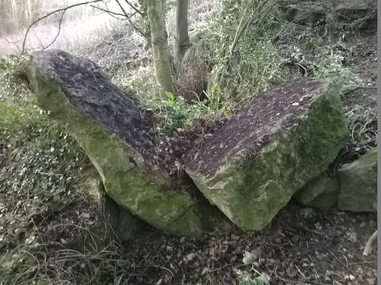
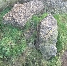
Left: Standing stones randomly heaped on top of each other
in Kingsdown Woods (photo ED)
Ara Krikorian
Summer 2014
Photos CMP unless indicated otherwise
Left: Standing stones randomly heaped on top of each other
in Kingsdown Woods (photo ED)
I have been living in Kingsdown for
almost six years and it was only at the beginning of this year that it struck me
that I was living in an area that had been utilised for spiritual worship
during the era predating the arrival of Christianity onto our shores. Why do I say that? In my opinion, the answer lies in the evidence
of the very many standing stones that
can be seen in the neighbourhood of Kingsdown.
I emphasise the words standing
stones as they unfortunately no longer stand per se but lie flat on their faces in the fields, or are
randomly heaped on top of each other in Kingsdown Woods, or artistically landscaped
into several residents’ rockeries or simply lie on roadside verges of Lower
Kingsdown Road to prevent unwanted parking.
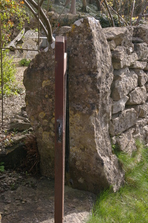
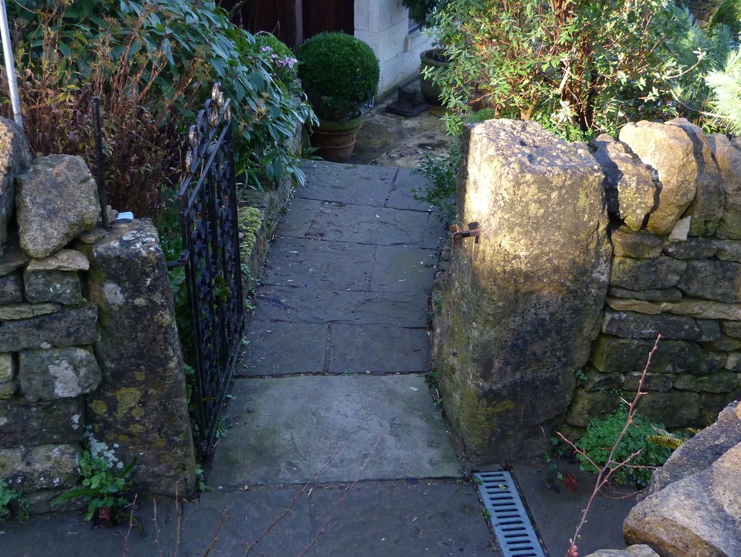
However, I have to point out that in one or two cases, they do actually stand as they have been built into either garden or field-boundary walls or used as gate posts as shown below.
However, I have to point out that in one or two cases, they do actually stand as they have been built into either garden or field-boundary walls or used as gate posts as shown below.
|
Photos Left: Gate post along Lower Kingsdown Road (ED) Above: Boundary marker in dry stone wall (Elisabeth Allen) |
Kingsdown’s
very own Standing Stones?
Wow; what a bold and outrageous statement to make I hear myself saying as I write. In addition, I immediately feel an empathy with anyone who is reading this article and jumping to the conclusion that Ara is trying to be sensationalist by grabbing the headlines or if I’m realistic, admitting that the reader is more than likely concluding that Ara has been retired for too long and is ready to be cared for.
That said, please let me give a background to what standing stones are before putting forward my argument for the case I’m trying to make, ie that there were at one time, standing stones in the Kingsdown area.
A simple definition of a standing stone is a stone that has been hewn from local rock (although some historians argue that a number of the rocks used for Stonehenge came from as far away as Wales).(3) These hewn rocks were then placed in the ground to form either a circle or a row/alignment, or simply placed in a chosen spot as a single menhir. Finally, standing stones were also used to form dolmens or tumuli.
It never ceases to amaze me that these standing stone formations exist in many areas of the world from as far as India (or even further east), throughout the Caucasus, all over Europe and last but not least, in many regions of the United Kingdom, such as Scotland, Wales, Northern Ireland, Cornwall and of course nearer home – Wiltshire!
It goes without saying that a simple definition of these formations is also required to whet the appetite of the reader so that his or her interest in this subject does not wane. So I will provide more detailed definitions based on the evidence I have gleaned during my travels in many parts of the regions of the world mentioned above backed up by…. of course you’ve guessed it: the instantly accessible reference library known as Wikipedia (where the following six pictures originate)!
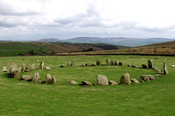
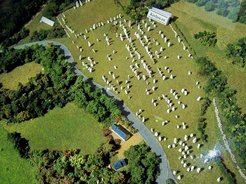
A stone circle (left: Swinside stone circle, in the Lake District) is exactly what it means, ie a monument of standing stones arranged in a circle. A stone row or stone
alignment (middle: Down Tor stone row on Dartmoor), is a
linear arrangement of upright, parallel megalithic standing
stones set at intervals along a common axis or series of axes. Stone Rows (right: Carnac, Brittany, France) may be individual or grouped, and
three or more stones aligned can constitute a stone row.

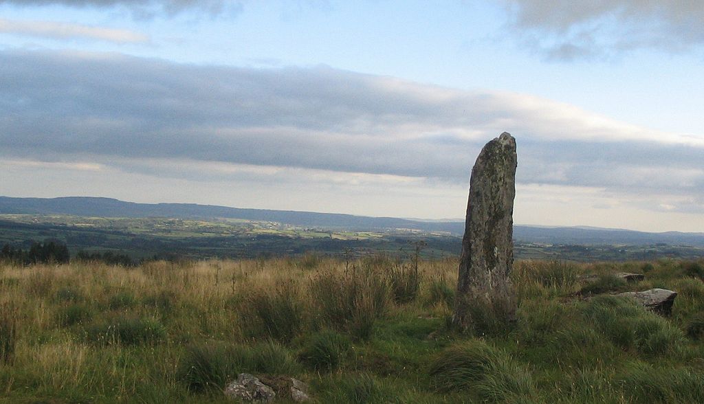
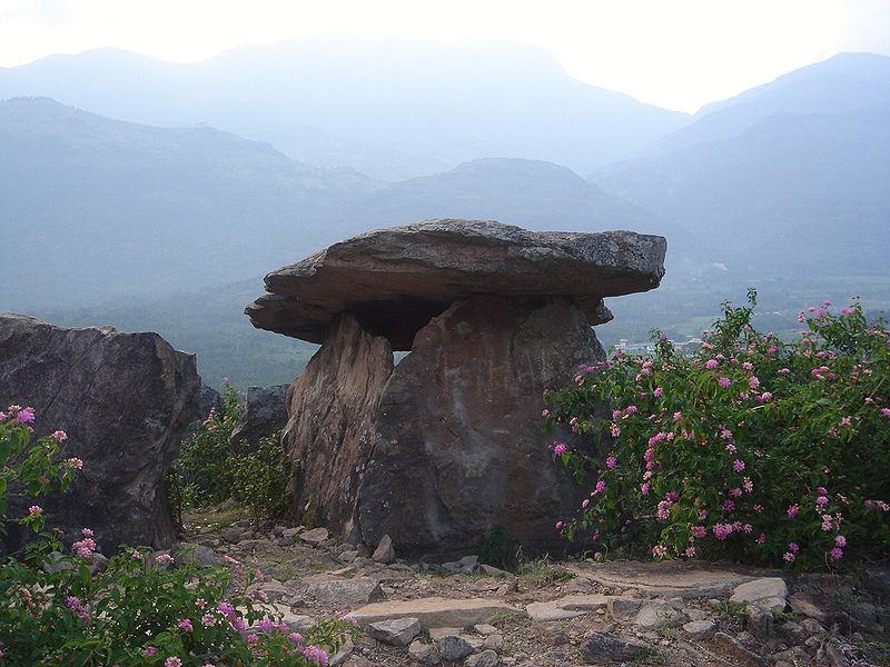
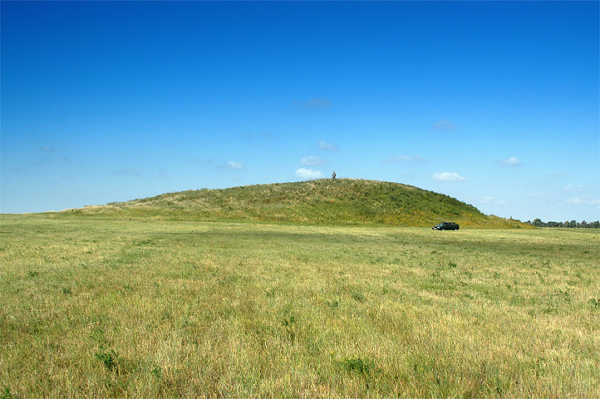
The name menhir is of French origin, from Middle Breton meaning: men stone and hir long and is a large upright standing stone. Menhirs may be found singly as monoliths (left: between Millstreet and Ballinagree, County Cork, Ireland), or as part of a group of similar stones such as in a circle or row. Their size can vary considerably, but their shape is generally uneven and squared, often tapering towards the top. A dolmen, also known as a portal tomb, is a type of single-chamber megalithic tomb, usually consisting of two or more upright stones supporting a large flat horizontal capstone (table). Dolmens were typically covered with earth or smaller stones to form a barrow. In many instances, that covering has weathered away, leaving only the stone skeleton of the burial mound intact (middle: dolmen in Kerala, India). A tumulus (plural tumuli) is a mound of earth and stones raised over a grave or graves (right: tumulus at Fillipovka, South Urals, Russia). Tumuli are also known as barrows. A long barrow is a long tumulus, usually for numbers of burials.
When Were They Used?
No article on such a subject would be complete if dates were not included as to when standing stones started to be utilised for worship or for whatever other reason they were erected, eg for the study of the stars and planets as shown below. Historians believe that standing stone formations developed in Britain from around 3000 to 2000 BC – in other words, during the later Neolithic period (when agriculture began in the UK) and moving into the earlier Bronze Age (when we see the first use of metals, from about 2400 BC).
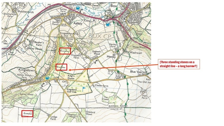
In order to justify my case to you the reader, who may be an historian or archaeologist or detective (or all three!), I have to ensure that the evidence I have provided is clear beyond all doubt. So how can I do that when there is no evidence of a standing stone circle, as in the case of Avebury, or row/alignment, as in the case of Carnac in Brittany, or a dolmen as shown above in Kerala, India and that all I can point to is a collection of stones lying flat or built into walls or used as gate posts? Well; for a start, I can provide the evidence that there are several tumuli in the area in question as shown in the Ordnance Survey map of Kingsdown.
No article on such a subject would be complete if dates were not included as to when standing stones started to be utilised for worship or for whatever other reason they were erected, eg for the study of the stars and planets as shown below. Historians believe that standing stone formations developed in Britain from around 3000 to 2000 BC – in other words, during the later Neolithic period (when agriculture began in the UK) and moving into the earlier Bronze Age (when we see the first use of metals, from about 2400 BC).
In order to justify my case to you the reader, who may be an historian or archaeologist or detective (or all three!), I have to ensure that the evidence I have provided is clear beyond all doubt. So how can I do that when there is no evidence of a standing stone circle, as in the case of Avebury, or row/alignment, as in the case of Carnac in Brittany, or a dolmen as shown above in Kerala, India and that all I can point to is a collection of stones lying flat or built into walls or used as gate posts? Well; for a start, I can provide the evidence that there are several tumuli in the area in question as shown in the Ordnance Survey map of Kingsdown.
Kingsdown Stones
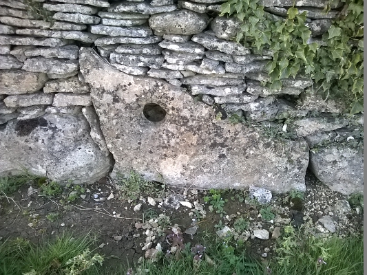
So what other evidence is there? Well; menhirs used as gate posts all over the UK, where farmers in particular have utilised them for entrances into their fields as shown in the photographs below taken in Jersey and Cornwall, can also be seen along Lower Kingsdown Road (one of which has already been shown at the start of this article). I have included a further example of a Kingsdown gate post to reinforce my evidence. I have also taken photographs of menhirs that have been built into the Kingsdown garden walls or dry stone walling demarking the boundary of farmers’ fields, some of which are included below.
So what other evidence is there? Well; menhirs used as gate posts all over the UK, where farmers in particular have utilised them for entrances into their fields as shown in the photographs below taken in Jersey and Cornwall, can also be seen along Lower Kingsdown Road (one of which has already been shown at the start of this article). I have included a further example of a Kingsdown gate post to reinforce my evidence. I have also taken photographs of menhirs that have been built into the Kingsdown garden walls or dry stone walling demarking the boundary of farmers’ fields, some of which are included below.
Menhirs used as gate posts in Lower Kingsdown Road
|
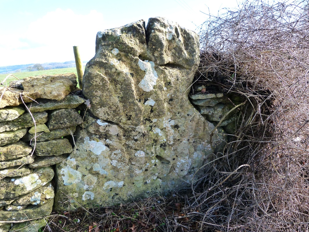
Menhir in dry stone walling of field boundary on the Kingsdown Golf Course
|
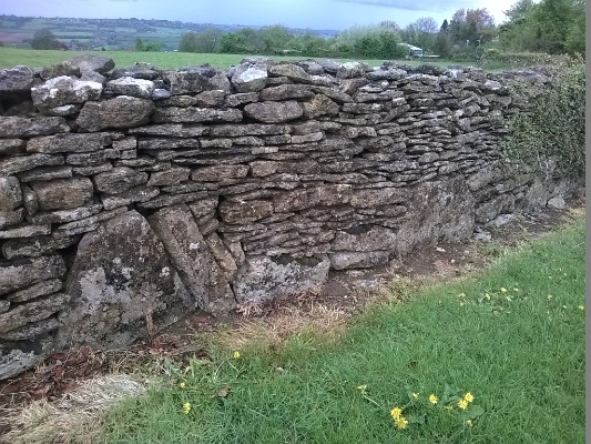
Several menhirs built into the dry stone walling on Kingsdown Golf Course
|
As stated earlier, menhir sizes and shapes can vary considerably but what is important to note is that they often taper towards the top as has been demonstrated in several of the photographs included in this article.
The standing stones (or menhirs as I have dared to classify them!) that are scattered around the Kingsdown area are on the whole pointed towards the top of their formed shapes as shown in the photographs below (the reader has to use his or her imagination and upright the stone in his or her mind to a vertical standing profile in order to fully appreciate the menhir shape). The first two photographs do not need any imagination as the up- righting process has been done for the reader by two members of the newly formed Kingsdown Investigatory Standing Stone Society (KISSS) (1):
The standing stones (or menhirs as I have dared to classify them!) that are scattered around the Kingsdown area are on the whole pointed towards the top of their formed shapes as shown in the photographs below (the reader has to use his or her imagination and upright the stone in his or her mind to a vertical standing profile in order to fully appreciate the menhir shape). The first two photographs do not need any imagination as the up- righting process has been done for the reader by two members of the newly formed Kingsdown Investigatory Standing Stone Society (KISSS) (1):
Up-righted stones showing the pointed end at the top of the stone
|
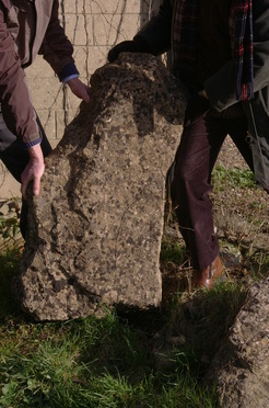
Kingsdown menhirs forcefully up-righted to demonstrate pointed top (ED)
|
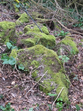
Menhirs covered in moss lying flat on their faces in Kingsdown Woods.
|
The next question that must be answered is: what reason can I give for so many standing stones ending up flat on their faces alongside the verges of Lower Kingsdown Road or in residents’ rockeries or piled on top of each other in Kingsdown Woods?
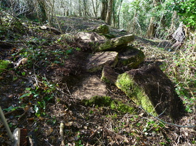
Menhirs piled up on top of each other in Kingsdown Woods
|
Menhirs lying flat on their faces on verges of Lower Kingsdown Road
|
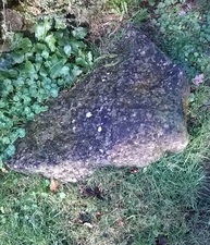
Common triangular shape on the verge of Lower Kingsdown Road
|
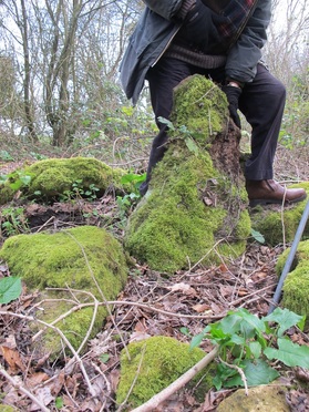
According to a very reliable source, the said person being someone who was a youngster during the Second World War, stones were laid on the Kingsdown Golf Course to deter any enemy aircraft from landing on their way back from having bombed Bristol (or perhaps on the way there to carry out the bombing exercise).(2) I was informed, Some of these stones were even larger than my car. Of course, we are all aware that our recollection of the size of objects that we memorise from our childhood days are naturally over exaggerated, ie the stones in question may not exactly have been of such size but when we consider the grouping of what I call The Three Sisters (3) lying piled up on top of each other, then the story recounted by the said person becomes realistic.
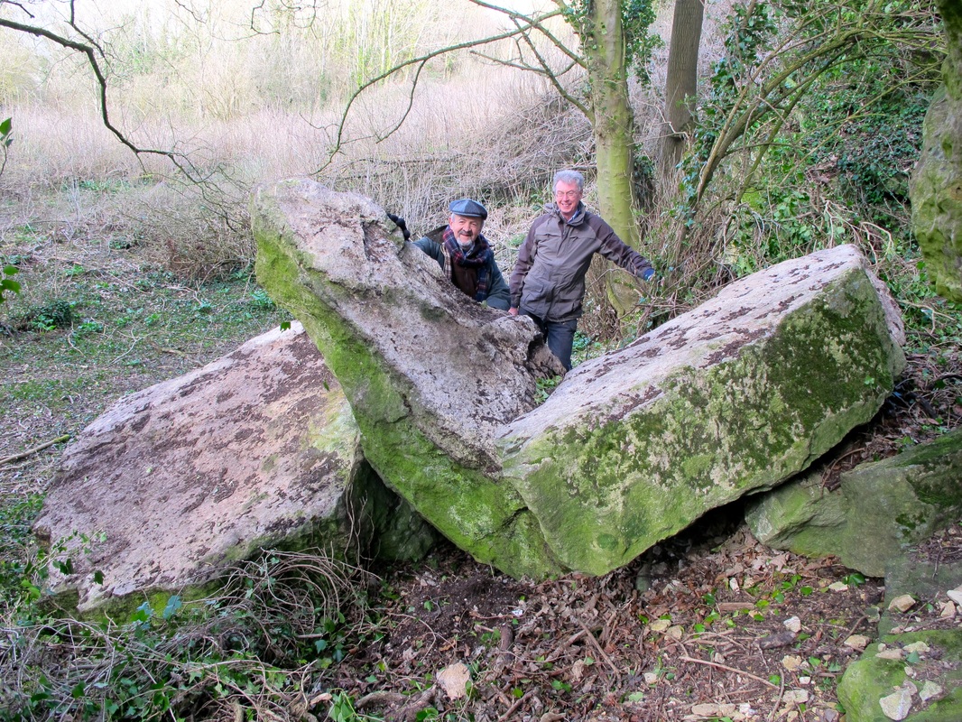
Two members of KISSS admiring the Three Sisters! Note the pointed tops of each menhir.
So if we have clear evidence that stones were piled up on the Kingsdown Golf Course during the Second World War, then we can naturally expect them to have been cleared off the golfing fairways at the end of the war, such clearing exercise more than likely not having been carried out in a logical and systematic manner. (I am sure that documentation and photographs of the stones on the fairways must exist in someone’s collection or attic - can anyone help locate such documentation for KISSS please?).
Furthermore, if such photographs exist, then they may well show more standing stones in their original alignment before being removed at the end of the war along with the ones that had been strategically placed on the fairways. (Note: Three standing stones still exist on a straight line which could well have been a long barrow as indicated on the map above).
So finally; the question that every reader is demanding to have answered, and quite rightly so; where are the dolmens (burial mounds)? I am of the opinion that there is at least one dolmen and maybe more but I can only provide evidence of a probable location in Kingsdown Woods. The photographs below provide some details. However, only a detailed archaeological investigation can prove exclusively whether or not my supposition is right. KISSS has made initial contact with the Archaeological concerns in Wiltshire County Council but sadly no funding is available to carry out even a visit let alone physical excavations. Should anyone know of any professional or amateur archaeologist who would be interested in coming to visit and explore the Kingsdown sites, then please will you let KISSS know?
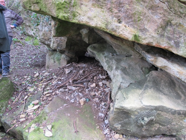
Possible entrance to a dolmen in Kingsdown Woods
|
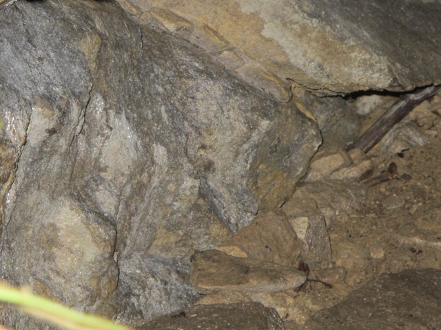
Inside the possible dolmen in Kingsdown Woods
|
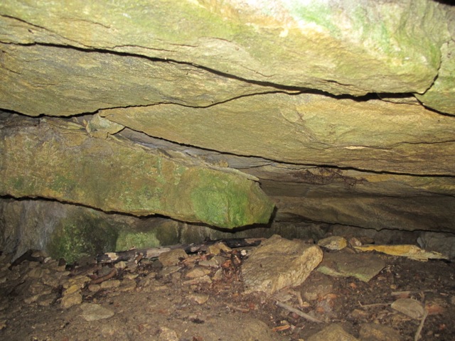
What treasures might be found by archaeological excavation!
|
Other Sites in South-West
I do hope that through the evidence I have provided, that I have managed to convince some, if not the majority of readers, that there had at one time been some formation of standing stones in Kingsdown. If I have failed to do so, then I hope that I have at least managed to whet his or her appetite to approach the newly formed KISSS to arrange a visit around the site(s) to see for themselves the stones that have been included in this article.
I also hope upon hope that someone in Box will be able to dig out old photographs that show the stones that were scattered all over the Kingsdown Golf Course during the Second World War in order to stop any enemy aircraft from landing in our neck of the woods (no pun intended!). That of course would greatly increase the abundant evidence already available (in my opinion of course!).
You can view more of the neolithic standing stone finds at Kingsdown at Neolithic Walk Around Kingsdown.
Is your standing stone listed?
Addendum
(1) Sometimes called the Three Kings, possibly a reference to Kingsdown.
(2) Name withheld by request
(3) Anyone interested in joining the working party should contact KISSS via the Contact tab. All interested persons are welcomed.
(4) KISSS member Elizabeth Devon adds: The large Stonehenge stones are sarsens from the surrounding area but the smaller inner ones are dolerite from the Preseli Mountains in Pembrokeshire.