Kingsdown in Tudor & Stuart Times Alan Payne March 2016
The King's Down was ancient by Allen's time, dating back to the Saxon period and earlier. It is referred to in a charter dated 1001 gifting land to the Saxon church at Bradford-on-Avon: and forth along his boundary until it comes to the King’s boundary at Heselberi (Hazelbury); from here it goes forth along the King’s boundary until it comes to Alfgares boundary at Attenwrthe (Atworth) and forth along his boundary until it comes to Lefwines boundary at Coseham (Corsham).[1]
The area has much earlier origins. The straight road to the south is a Roman road, the Via Julia which ran from Mildenhall to Bath, still the southern boundary of Box. What we don't see is any trace of the Wansdyke, the huge Saxon defensive ditch. It was reputed to run from Ashley Wood in the west, past a tumulus near Lodge Farm, along the boundary of Kingsdown following the line of the Roman Road, to Norbin Farm.[2] Its existence has been disputed because it is scarcely visible in places but it was mentioned in Saxon charters from the 800s and it is still a significant structure at Neston Park.[3]
The area has much earlier origins. The straight road to the south is a Roman road, the Via Julia which ran from Mildenhall to Bath, still the southern boundary of Box. What we don't see is any trace of the Wansdyke, the huge Saxon defensive ditch. It was reputed to run from Ashley Wood in the west, past a tumulus near Lodge Farm, along the boundary of Kingsdown following the line of the Roman Road, to Norbin Farm.[2] Its existence has been disputed because it is scarcely visible in places but it was mentioned in Saxon charters from the 800s and it is still a significant structure at Neston Park.[3]
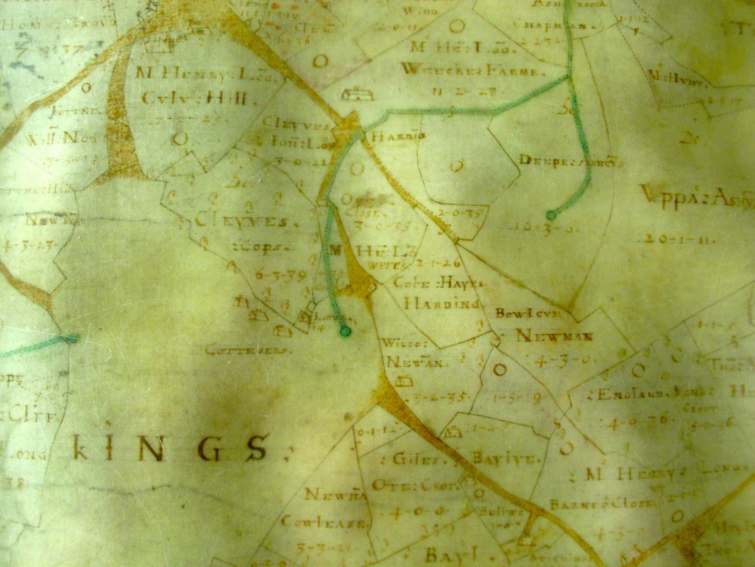
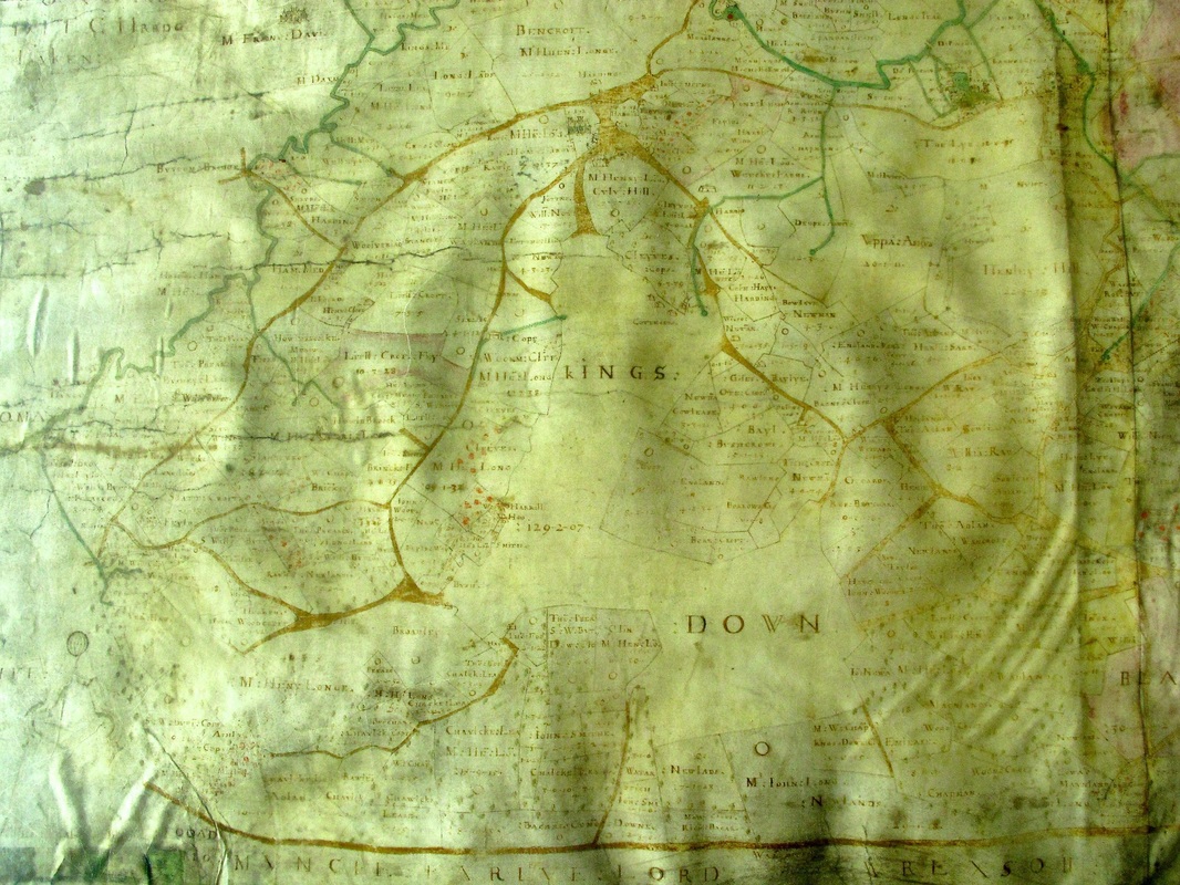
The name Down relates to an open grazing area, not arable, used by the commoners (local villagers).It wasn't ideal for arable crops because it had fewer springs and was more exposed. It was also too far away from the centre of the village. There is no knowledge of the first king who owned the area and gave it the name Kingsdown. We welcome any thoughts you have about this.

The peculiar shape of Kingsdown indicates that it was probably once a much larger area. The perimeter of Kingsdown appears to have been nibbled off, with small fields taken into farming use. We can see evidence of this from field names referring to New (meaning since feudal times), such as New Lads and New Lands.These are medieval incursions, whilst areas called Close and Croft are more likely to be Tudor.