Tudor & Stuart Hazelbury Carol Payne March 2016
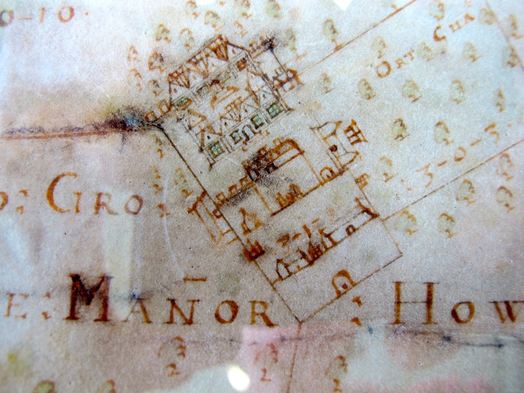
The map shows an Elizabethan-style house at the head of a walled courtyard with an entrance gate. There several other buildings inside the wall for servants, carriage and domestic staff, not the personal staff who lived within the main premises.
It was a self contained, private area within a a wall and protected by servants. And there was a larger enclosure surrouduing the residence comprising the grounds of the house.
It was a self contained, private area within a a wall and protected by servants. And there was a larger enclosure surrouduing the residence comprising the grounds of the house.
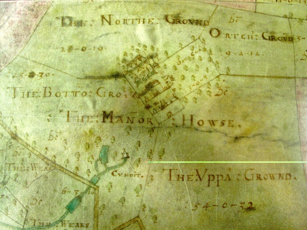
This extract above shows a slightly largeer view of the Hazelbury estate. The house is seen set within a domestic orchard and an area called Orchard Ground. The horses needed for travel and pleasure probably grazed at nearby Bottom Ground or North Ground. At the bottom of the map are the ponds and water water supply needed for the house and its occupants. The word CVDIT may be an abbreviation of Conduit for altering the route of the stream. There is also a fascinating picture of a chapel shown at the end of the conduit stream. There is still an ecclesiastic-styled window that can be seen in one of the buildings in this area.
We might presume that the estate was largely self-sufficient for fruit and vegetables, water and domestic timber needs. But the house needed to interact with their tenants and the services provided in the centre of the village. The road at the bottom left is Wyres Lane leading down into the village.
We might presume that the estate was largely self-sufficient for fruit and vegetables, water and domestic timber needs. But the house needed to interact with their tenants and the services provided in the centre of the village. The road at the bottom left is Wyres Lane leading down into the village.
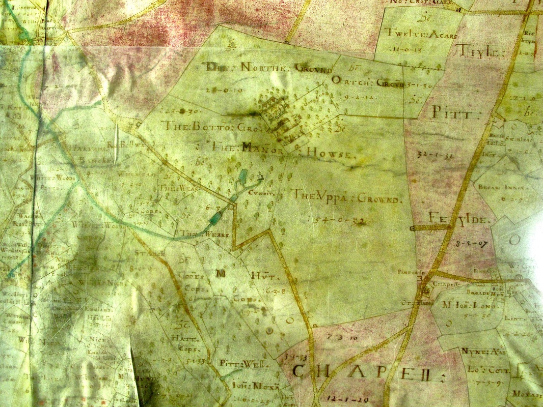
This extract of Allen's map shows the conduit water was part of a weir system, presumably for agricultural needs rather than house supplies. The chapel at the head of diverted stream may have had sacred spring significance.The heavy line around the grounds is the road system of the area. Nowadays we regard these as tracks rather than roads and there does not appear to be the modern access path from the Chapel Plaister corner to the front of the house.
The church at Chapel Plaister is clearly marked as CHAPELL, leading into the hamlet of Wadswick and its properties. The grounds to the south of the chapel are called Chapel Field and this now forms part of the land we call Wasdwick Common.
The church at Chapel Plaister is clearly marked as CHAPELL, leading into the hamlet of Wadswick and its properties. The grounds to the south of the chapel are called Chapel Field and this now forms part of the land we call Wasdwick Common.

Finally, the 1630 map shows us better the situation of the Hazelbury House in relation to the rest of the village. Wyres Lane leads directly down to the east side of Box, becoming the east part of the Market Place road (once called Frog Street), then into the Mill Lane (which now runs beside the Post Office) and goes directly at Box Mill. The ownership of the mill by the lord of the manor is obvious from this directness.