Central Box Village in Tudor & Stuart Times Alan Payne March 2016
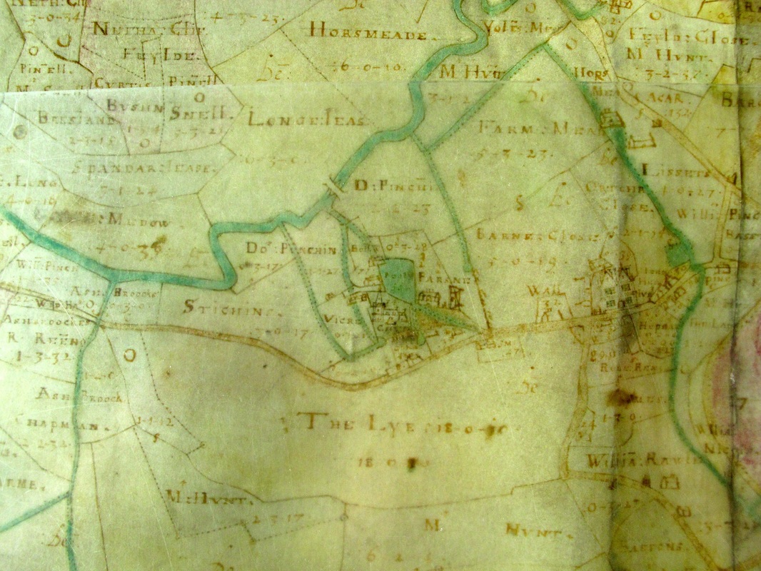
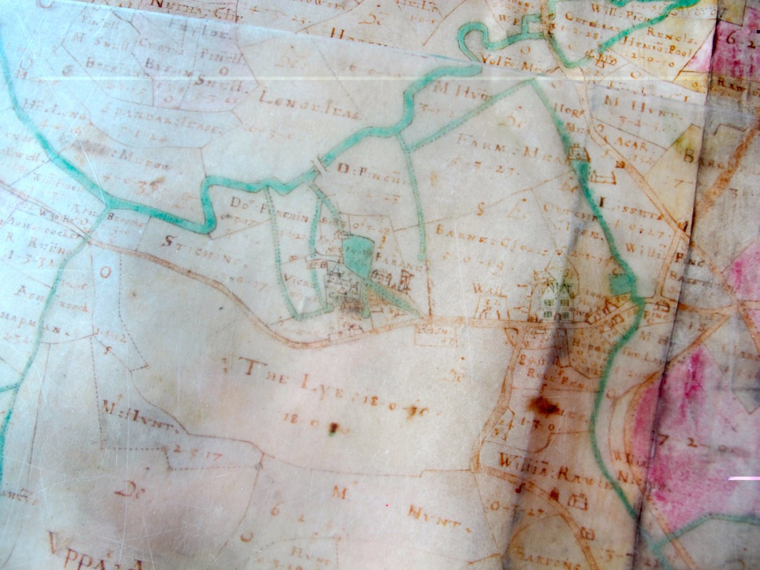
The influence of the church and the Manor House are obvious from this extract of Allen's map. It is also clear that the number of residences and people living in the centre of Box was minimal at this time. Because people's survival still depended on growing their own produce and tending a few animals, villagers were obliged to look for cottages with a little land in the outlying hamlets.
The Market Place is shown as the main road through the village (albeit that it is shown too close to the Manor House). The present A4 road did not exist. Houses are shown on both sides of the road. A stream is seen as diverted from the By Brook down through the valley now between the school and Fairmead View.
The Market Place is shown as the main road through the village (albeit that it is shown too close to the Manor House). The present A4 road did not exist. Houses are shown on both sides of the road. A stream is seen as diverted from the By Brook down through the valley now between the school and Fairmead View.

Seen above Box Church and the Wilderness together with the old parsonage (PARSNE). This is confusing because the PARSNE is seen to the east of the church, whereas traditionally we have believed that the parsonage was to the west of the church on the site of the current Box House. The PARSNE seems to be on the same site as the current vicarage. Can anyone suggest the answer to the contradiction?
The Manor House
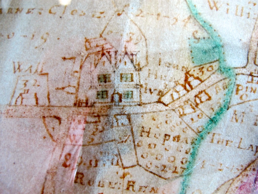
The Manor House is not shown as a particularly grand building in the centre; it was, after all, just a tenanted property for the Speke family to generate an income. To the west is Manor House Barn and beyond it a walled area and a residence, presumed to be the pound and the pound-keepers cottage. There are a few buildings around the Manor House but it is not possible to see if they are related to the farm. St Jude's Cottage and the old County Stores are believed to be farm labourers' cottages.
The house is shown surrounded by agricultural fields, see below. Opposite appears to be an orchard although it has not been possible to decipher the field name HUPGAR - could it possibly be Hop Garden?
The house is shown surrounded by agricultural fields, see below. Opposite appears to be an orchard although it has not been possible to decipher the field name HUPGAR - could it possibly be Hop Garden?
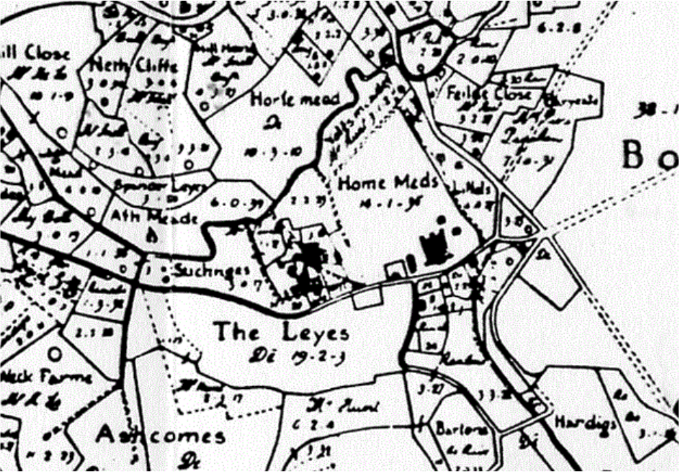
The fields around the Manor House show its agricultural origins. Behind was Barn Close and what may be Orchard Close, then came Home Meadows. More interestingly is the field called Horse Meadow in Allen's map. This may be a reference to feudal times when the lord of the manor was one of the few people wealthy enough to own horses for domestic, transport and knightly services. The Manor was called Manor Farm in later years and there is still evidence of the cowsheds which surrounded the yard, now used by Manor Garage.
The Lay (called Leyes) was an area rather than a road and it was large at over 19 acres. It was a meadow field for grazing animals, probably commonland because of the use of the plural. Off to the east of the road was an area later called Box Bottom, where in the mid 1900s there was a pond for dipping sheep.
The Lay (called Leyes) was an area rather than a road and it was large at over 19 acres. It was a meadow field for grazing animals, probably commonland because of the use of the plural. Off to the east of the road was an area later called Box Bottom, where in the mid 1900s there was a pond for dipping sheep.
There is evidence of farming improvements in the hay fields along the By Brook opposite Saltbox Farm. Even today lines of reeds mark out sluice channels which stay wet in summertime. Probably there were sluice gates to control the flow of water back into the brook and it is possible that the gate at Saltbox Farm controlled water to the hayfields as well as Drewetts Mill, although it is not possible to date these to Tudor or Stuart times and they are more likely to be Georgian farming improvements.