Ashley in Tudor & Stuart Times Alan Payne March 2016
We can sometimes reconstruct history where there are no surviving records from the lanscape and field names. This is true of Ashley, where the area has continuity of geography, house- and field-names because it has avoided wholesale redevelopment.
We have seen in another article that in Victorian times the hamlet evolved as ribbon development along Ashley Lane, the western route out of Box to Bath and Bristol.[1] Traditionally it appears to have been a long-established agricultural area. Compared to other sides of Box, it was easier to farm with less steep hills and abundant water supplies. By 1880, it was primarily a milk area with several smallholding dairy farms.
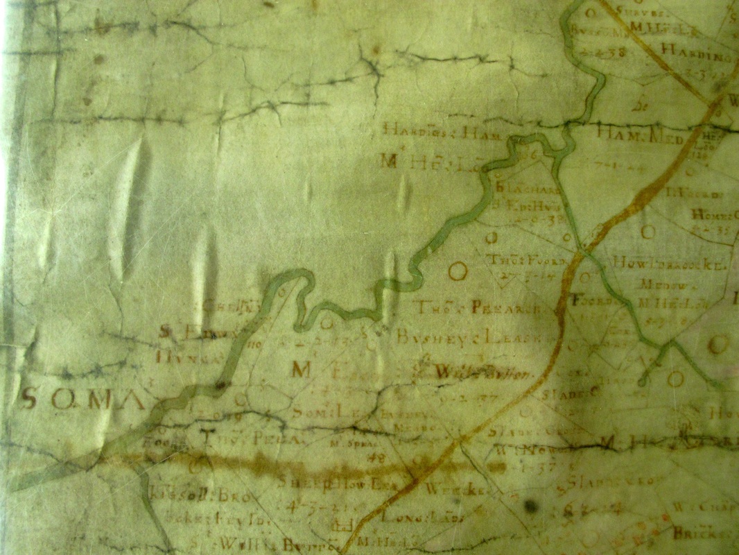
Francis Allen's 1630 map shows the remains of Saxon field-strip farming, where the local residents agreed to farm jointly, all growing the same crops and pooling resources to harvest them. There are some along Ashley Lane beyond the Grove site; others off Doctor's Hill; and more to the west of Wormcliffe. But these were rare in Stuart times and most of the land in the area was small enclosed fields averaging perhaps six or seven acres.
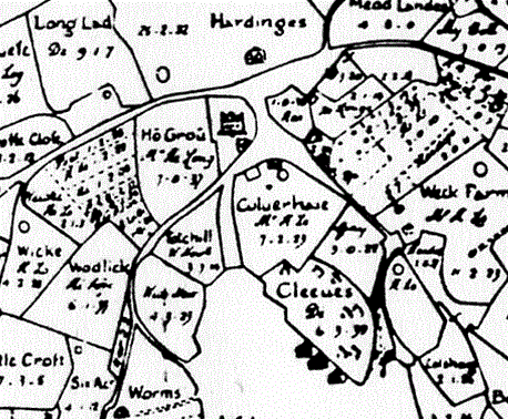
There are more topographical clues, albeit to be used with caution. A number of houses in the area have the name Croft. There is Ashley Croft and Crofton on Ashley Lane and elsewhere Stonecroft, Elmscroft and Croft Cottage. Some of these are the whim of modern owners but others refer to the old field name. The word croft refers to land enclosed as a private house and garden out of a larger holding. Francis Allen's map gives field names of Little Croft, Burrow Crofts, Oate Croft and Burcow Croft.
We know that the Mountford family controlled Ashley in medieval times, and that their estate passed into the control of the Butler family.[2] A legal case in 1583 defined the entitlement of Alice Butler (heiress to the Mountford dynasty) to income from her late husband's estate, described their lands as: 1,000 acres of land (arable), 500 acres of meadow, 800 acres of pasture, 200 acres of wood.
The estate passed to the Long family of South Wraxall through marriage. After 1550 a very junior branch of the family settled at Ashley when Anthony Long, the fourth of seven sons of Sir Henry Long (1489-1556), married Alice Butler, heiress of Ashley. Anthony Long was buried in Box Church in 1583 and his effigy carries the inscription: Here lyeth the body of Anthony Long, Esqr, buried 2nd of May 1578. John Aubrey describes them later as: The Longs are now the most flourishing and numerous family in the county.
The Long family were new gentry, deriving their money from the cloth industry.[6] They were very wealthy and Robert Long built South Wraxall Manor about 1429 using Box stone for some of the building. They were adventurers on the make and Aubrey claimed that Sir Walter Long (a friend of Sir Walter Raleigh) introduced tobacco to Wiltshire.
The Long family were new gentry, deriving their money from the cloth industry.[6] They were very wealthy and Robert Long built South Wraxall Manor about 1429 using Box stone for some of the building. They were adventurers on the make and Aubrey claimed that Sir Walter Long (a friend of Sir Walter Raleigh) introduced tobacco to Wiltshire.
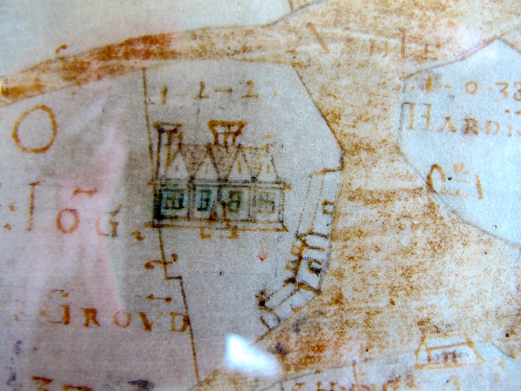
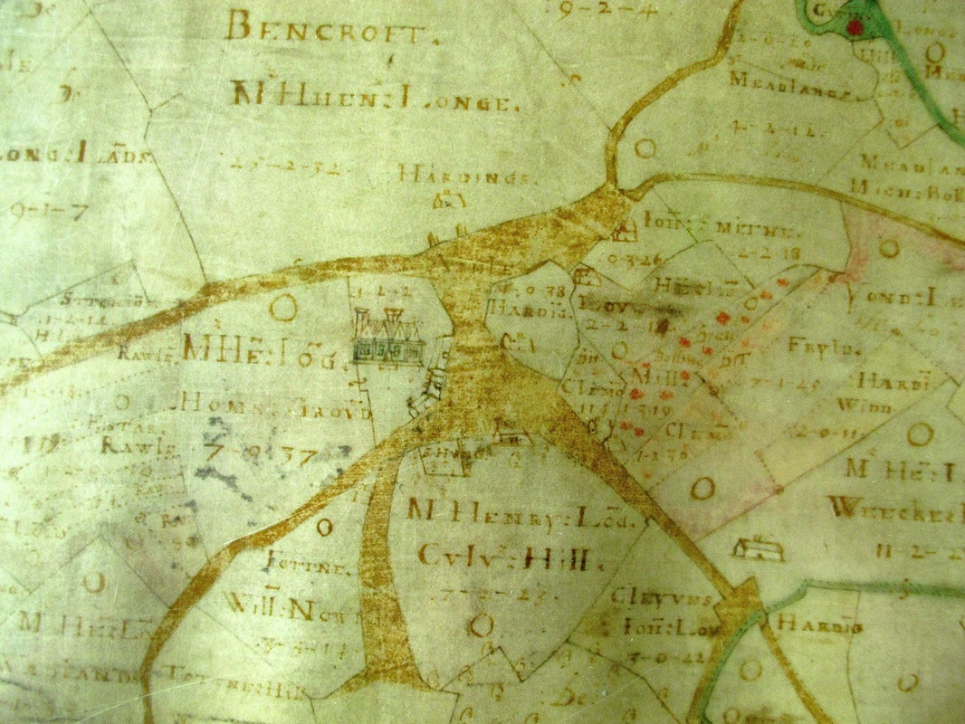
The Longs rebuilt Ashley Manor in about 1555 and the house was small compared with its modern appearance, although Francis Allen clearly thought it a significant property for the time. There remains a question about how a younger son of Sir Henry was able to afford the building of Ashley Manor and supported him with an income thereafter. We know that the mechanisms of the Elizabethan government allowed some people to rise rapidly to the status of local gentry using their influence as local Justices of the Peace. Henry Long of Ashley described himself as gent in 1610. They were unpaid but they reimbursed themselves by exploiting tax advantages and local opportunities.
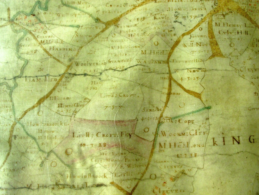
We can see on Allen's 1626 map that Woorm Cliff was a field rather than a road. We can also see Wormcliffe House against a name Cope and a curious triangular territory with 60 written in it. We don't know the meaning of this; could it possibly be the pilgrim's chapel which still exists there?