The Roman Road in Box Alan Payne June 2017
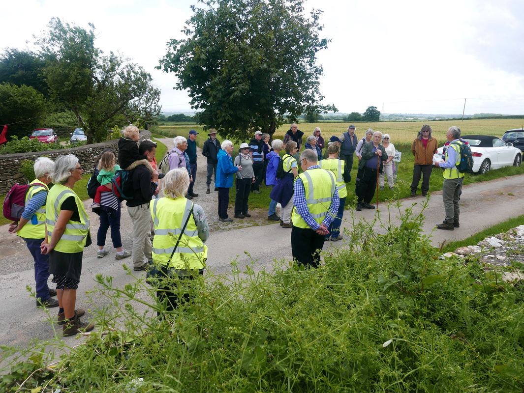
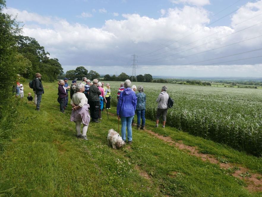
Assembling at the Hatt Farm track (courtesy Carol Payne)
On the first walk of 2017 we welcomed visitors to the Old Jockey area to explore the remains of the Roman Road, part of Via Julia from Mildenhall (Marlborough) to Bath, which still forms the southern boundary of the parish. The road was probably early second century, mostly used for military purposes. It now exists as a hedgerow with glimpses of wall but it is still more visible than Box Villa & the Fosseway past Alcombe.
The road follows adjacent to an ancient Celtic ridgeway track (now the Kingsdown Road), where there are three round barrows nearby and another at Totney, Kingsdown. As a major prehistoric route, these ancient origins highlight how isolated Box was, bypassed by two roads.
The road follows adjacent to an ancient Celtic ridgeway track (now the Kingsdown Road), where there are three round barrows nearby and another at Totney, Kingsdown. As a major prehistoric route, these ancient origins highlight how isolated Box was, bypassed by two roads.
Re-Discovering the Roman Road
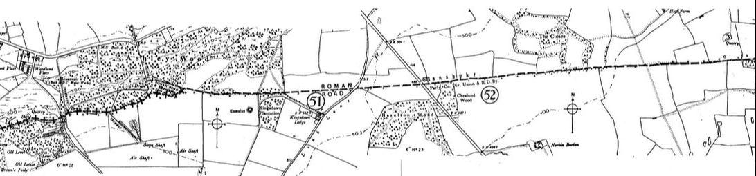
The Roman Road was rediscovered in 1819 by Sir Richard Colt-Hoare, who owned Stourhead and was the antiquarian who excavated Stonehenge and Glastonbury Tor. By that time the road had fallen into disuse, identified only as a broad strip of land belonging to no one. Colt-Hoare described his findings in detail:
We ascertain it precisely (when) we reach Ashley Wood, where its elevated ridge becomes visible, having a stone quarry on each side of it, and forming a boundary between the parishes of Box and Monkton Farley. At the extremity we found its span measured thirty feet ... we noticed a trench cut on the South side of the road almost wide enough to admit a cart, which cavity is denominated Bulcot Lane... The elevation of the causeway still continues visible through the fields, where it is not much more than eight feet wide, owing to its having been destroyed for the sake of materials.
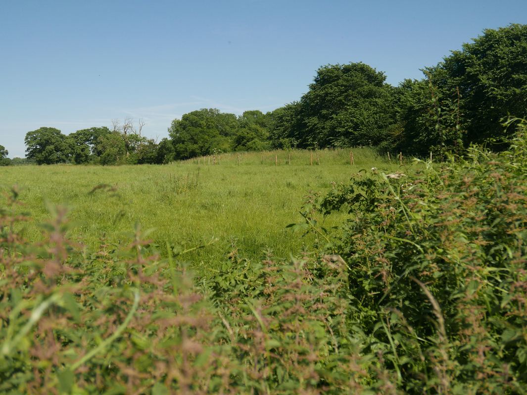
The road is mostly seen as a raised track (courtesy Carol Payne)
|
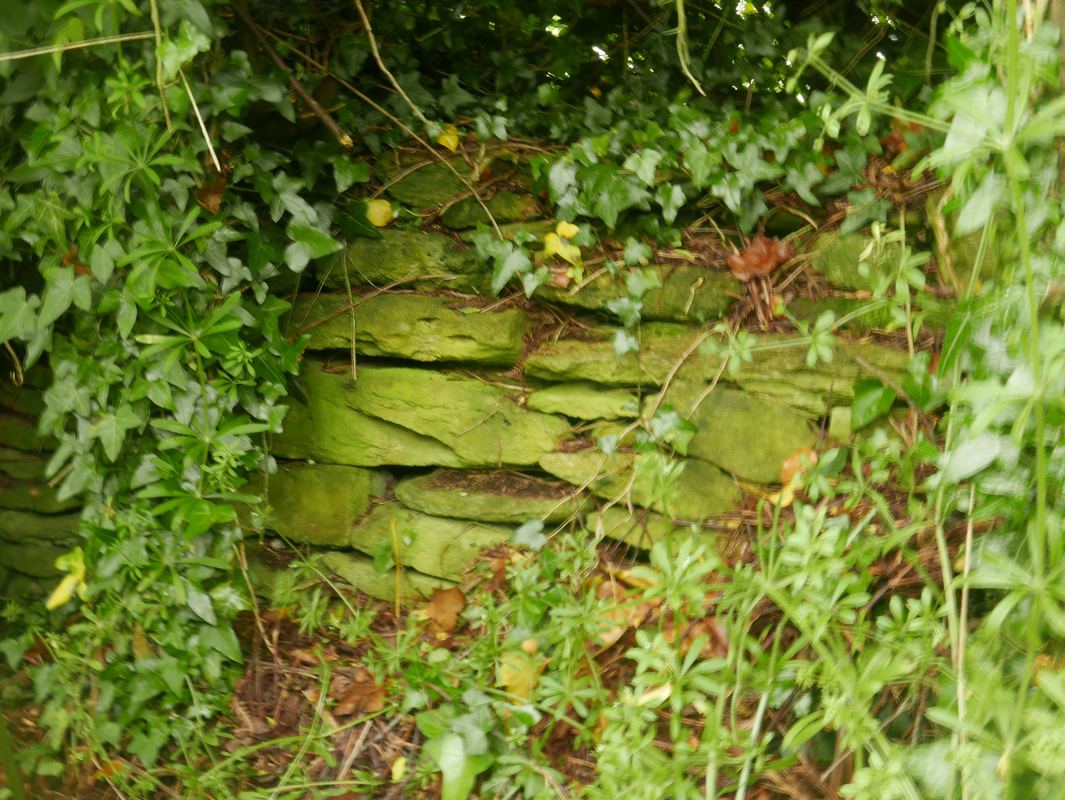
Muh of the stone was robbed for local walls and buildings (courtesy Carol Payne)
|
Box in Viking Times
A royal charter in 1001 mentioned the road when it recorded the boundary of Bradford-on-Avon land given to St Lawrence chapel in anticipation of Viking raids:
... and so by the Abbot’s boundary to Alfgares boundary at Farnleghe (Farleigh) and forth along his boundary until it comes to the King’s boundary at Heselberi; from here it goes forth along the King’s boundary until it comes to Alfgares boundary at Attenwrthe (Atworth).
It was a time when the Vikings threatened to take control of the area. In 1011 a Saxon army gathered at Corsham to try to fight Danish intruders who had to be bought off by a massive national danegeld (ransom levy) of £48,000. In 1015 the Viking ruler Cnut (sometimes called Canute) sailed up the River Frome, destroying the monastery at Bradford.
The road naturally divides the area and the type of crops that can be farmed (courtesy Carol Payne)
Natural Topographical Boundary
We explored the physical differences in the area where there is a geological fault line. The field to the north of the road is the last field in the Cotswolds. The soil differs with rocky brash soil on the Box side and sandy soil on the Bradford side, sometimes used for growing potatoes.
There have been human interventions in the topography too. A defensive earthwork called Wansdyke (after the god Woden, who gave us Wednesday) was built along other parts of the Roman road. It was probably a defensive barrier or boundary marker mentioned in Saxon charters from the 800s but in Box the only ditch that shows is probably just the Roman vallum (ditch) alongside the road.
World War 2
The 100 acre field on the Bradford side of the road was used in World War 2 to persuade German surveillance that this was Colerne Airfield. It had over 300 mounds of stone placed on the field to resemble a bomb-pitted airfield. The Pope family who farmed at Norbin Barton had to be evacuated every night as a protection against bombing and an air raid shelter was built at Norbin with a single phone line for Air Raid Protection wardens to report raids. An Allied plane crashed there with death of the trainee pilot during the war years.
Droving Road at the Closes
In medieval times the route through Kingsdown was used by drovers to herd flocks of animals from Wales and the West into London. Often involving flocks of 200 cattle or 2,000 sheep, the Roman road was too narrow for animal traffic and so the nearby ridgeway route was used instead. This drove road merged into Kingsdown near Monkton Farleigh Road, along the significantly named Link Lane.
Clumps of Scots Pine trees were used to advertise accommodation for drovers and fields for animals. The tree-enclosed field called The Closes and Closes Farm were short-stay animal enclosures. Droving was used for banking purposes to avoid highwaymen, money being converted into animals, driven across the country and then converted back into cash at the destination.
|
Georgian Influences
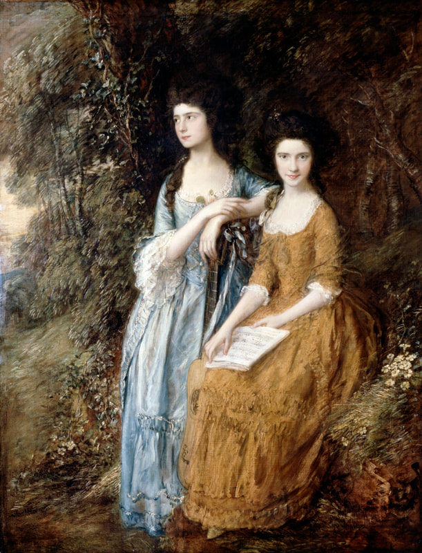
The 1770 map of the area by William Simpson, surveyor, reported a hangman's gallows at Chapel Plaister. The Black Act of 1723 had introduced the death penalty for over fifty crimes including wearing disguises in a forest, the destruction of fish ponds and trees, and setting fire to hay or straw ricks. Beyond the Kingsdown Golf Club, Kingsdown Farm is reputedly called Hangman's Corner, Kingsdown. A famous Georgian love triangle resulted in a duel on Kingsdown in 1772 between playwright Richard Brinsley Sheridan and Captain Thomas Mathews, a married man. The lady involved was a celebrated seventeen year-old soprano singer, Elizabeth Ann Linley, a family friend of Gainsborough. It was a bloody event: Sheridan was borne from the field with a portion of his antagonist's weapon sticking through an ear, his breast-bone touched, his whole body covered with wounds and blood, and his face nearly beaten to jelly with the hilt of Mathews' sword. Matthews fled to France fearing Sheridan was dead and he would be charged with murder but the playwright did recover. Right: Gainsborough's painting of Elizabeth Linley and her sister Mary (courtesy Google Art Project) |
|
Conclusion
The walk concluded with an investigation of standing stones in a coppice, seen above. Thanks go to landowners Mike & Carol Pope and Sir Charles Hobhouse, for allowing this. The walk was followed by tea and a display of Roman coins by Richard Jeffery and of finds made on Box's Roman Road.
The walk concluded with an investigation of standing stones in a coppice, seen above. Thanks go to landowners Mike & Carol Pope and Sir Charles Hobhouse, for allowing this. The walk was followed by tea and a display of Roman coins by Richard Jeffery and of finds made on Box's Roman Road.