Recalling Box Quarries Richard Pinker March 2017
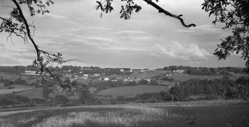
Box Hill photographed from Colerne (courtesy Richard Pinker)
The golden age of quarrying is now a century ago and there are no quarrymen alive from that time. Despite fierce opposition from councillor Aubrey Pinker and others many quarries were allowed to be ruined in the years after World War 2, blocked up or used as waste tips. This article seeks to remember them so that they should never be obliterated from our village memory.
Pinker Family
I grew up in the Boxfields area where my ancestors had lived for several generations. Aubrey Pinker was my father and we used to live in No. 1 Tunnel Inn, a pub long ago but not in our time. Rhoda Ann Oatley was my grandmother. The Pinkers came to Box in the early 1800s from Christian Malford, north of Chippenham. They, and particularly the Oatleys, who came from the Melksham / Bromham area) in the mid 1800s, seem to be related to a lot of the families in Box. Percy Chandler was related to the Oatleys.
I grew up in the Boxfields area where my ancestors had lived for several generations. Aubrey Pinker was my father and we used to live in No. 1 Tunnel Inn, a pub long ago but not in our time. Rhoda Ann Oatley was my grandmother. The Pinkers came to Box in the early 1800s from Christian Malford, north of Chippenham. They, and particularly the Oatleys, who came from the Melksham / Bromham area) in the mid 1800s, seem to be related to a lot of the families in Box. Percy Chandler was related to the Oatleys.
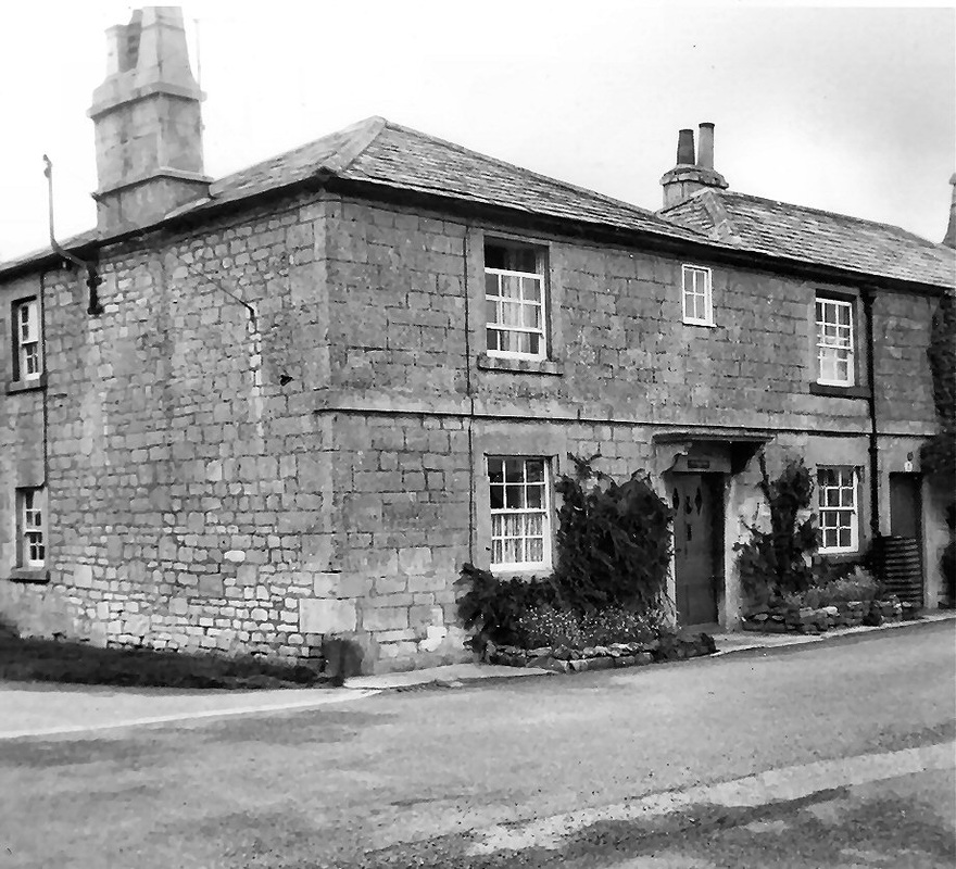
Tunnel Inn in 1950s
|
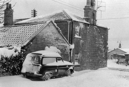
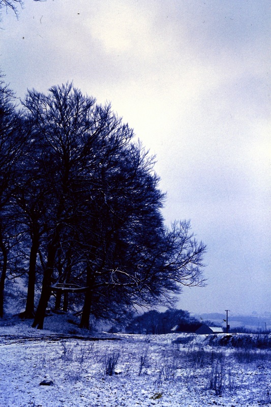
Snow in December 1962
|
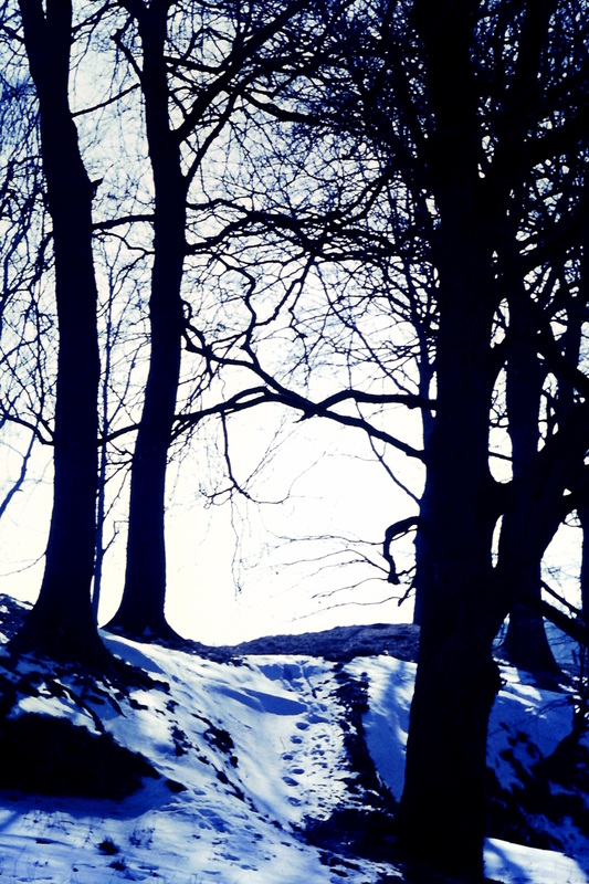
Box Hill Quarry
|
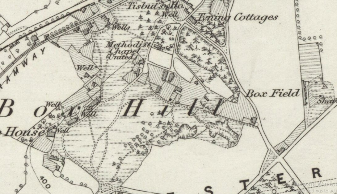
A question that I have been trying to puzzle out is the precise location of the old quarries across the field from Tunnel Inn.
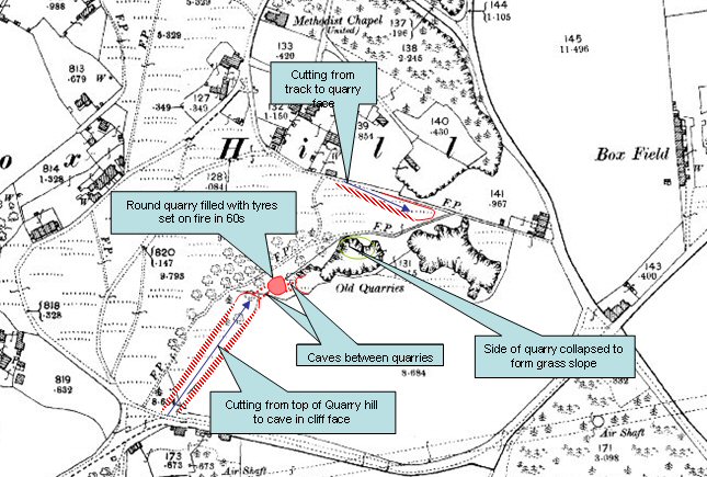
My first point of call was this map of 1900 which seems to show them but it doesn't tie up exactly with my memories. I attach my annotations on the map which show my memories. I know that the quarries were filled in when they knocked down the Boxfields estates but the quarries I played in would have been worked before 1900. Right: Ordnance Survey map of 1900 |
|
|
Subsequently I found an earlier map, 6 inch to 1 mile Ordnance Survey map of 1885-89, which shows the quarries how I remember them.[1] I believe that the round quarry in red on the 1900 map is in fact a collapse of the cave beneath.
I used to walk from the top of Quarry Hill along the cutting and into the cave. It then required a climb up through a gap into the round quarry, then down through a gap into the cave to the quarry with grassy slope. Left: Ordnance Survey map of 1885-89 |
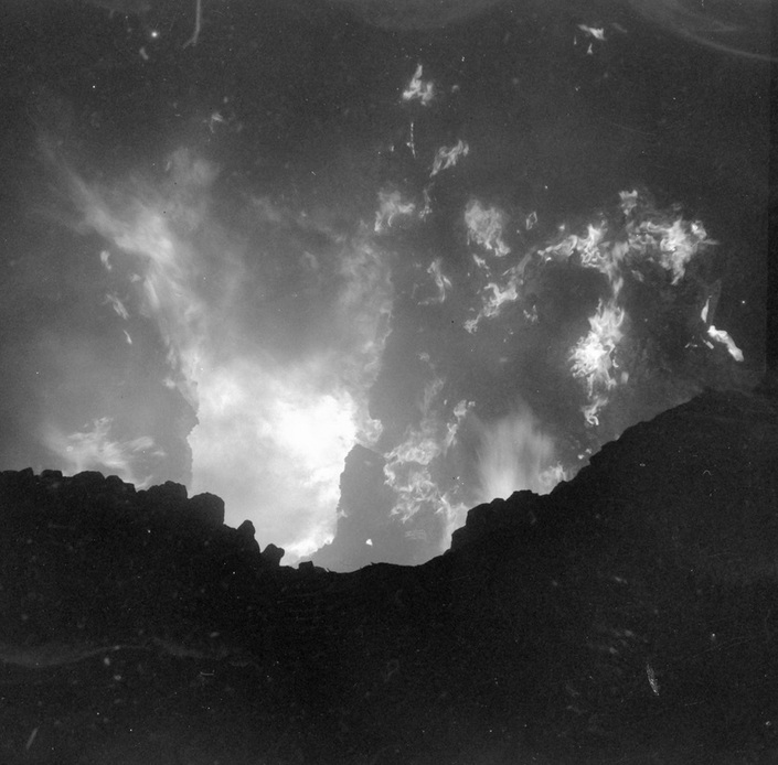
The despoiling of the quarries started in the early 1960s. As far as I recall, somebody dumped tyres in the round quarry shown in red on the map above and they were set on fire. They burnt like a furnace since they were fed with air from the caves. It was probably a Friday as I was home and took the photo.
Picking Over the Waste
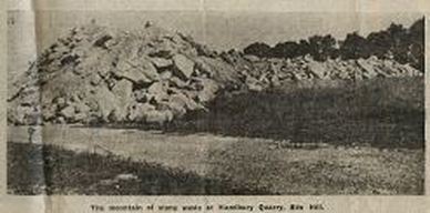
In the late 1960s the council gave permission for open-caste working on the old quarry spoil heaps. By 1970 this old waste from a century earlier was yielding larger pieces that had been ignored previously but the waste spoil had caused problems.[2] Another huge mountain of stone waste grew up at Hazelbury; it had grown to such proportions that it is showing up from the opposite side of the valley at Colerne.
In the late 1960s the council gave permission for open-caste working on the old quarry spoil heaps. By 1970 this old waste from a century earlier was yielding larger pieces that had been ignored previously but the waste spoil had caused problems.[2] Another huge mountain of stone waste grew up at Hazelbury; it had grown to such proportions that it is showing up from the opposite side of the valley at Colerne.
|
Many residents complained abut the problem. Mrs Patricia Tooth of 2 Berry Cottages warned of the dangers to children and that it was so unsightly. My mother, Nellie, and my father (both councillors), lived nearby at 1 Tunnel Inn. They spoke of the ambiguity that new houses could not be built in the green belt area but the spoil heap had been allowed. Victor Holder of Boxfields, a 63-year old ex-quarryman, and his neighbour Mrs Annie Milanowski both complained of the unsightliness.
|
|
|
Quarrying Nostalgia
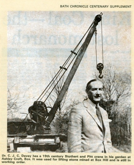
As the workings were in their final stages, there were a few old quarrymen who remembered the old days. Jack Dancey, who had been born in 1898, had started work as an odd-job boy in Clift Quarry.[3] He recalled how the miners had worked using lights made from a small tin and a bicycle inner tube which burnt benzoline. He spoke of the times around the First World War, when a seven foot saw (was used) to cut a three foot deep block of stone (and) hand cranes (were used) to pull the stone out. People foresaw the need to preserve the memory of the quarries. Bob and Lauri Hancock, at the time tenants of the Quarryman's Arms pub at Box Hill, preserved many quarrymen's saws and picks, which you can still see displayed at the pub. When he and Lauri gave up the tenancy of the pub in 1972, Dr Jim Davey took control of their old crane. Left: Bath Chronicle showing the crane |
Debate Over Infilling
There was often trouble at this time with youths coming from far and wide to explore and inevitably getting lost underground.[4] There were numerous entrances and, probably because of their use by children, the Quarry Woods site was the most vulnerable. As far as I remember none of my generation got lost having grown up playing in them. I now shudder at what we used to do - playing hide and seek in the pitch dark in collapsing caves with burning Perspex for illumination.
One by one the vested interests sought to distance themselves from responsibility for control of the underground workings. Kingston Minerals Limited claimed that, after a hundred years, the mines were no longer the company's responsibility.[5] Roger Barton who owned Manor Farm, Wadswick, said he did not own the mineral rights.
It was only in the mid 1960s that the quarries began to get filled in by tipping waste into them. Along with others in the 1970s, my father, Aubrey, who served on the Calne and Chippenham Rural District Council, fought hard for them to be preserved, saying that They are the birthplace of industry in this area.[6] The tunnels may not be a Stonehenge but I think they should be declared an ancient monument. They could be opened to the public and rare plants and ferns grow in them and right inside the tunnels there is an unusual species of bat. Richard Fudge of Box Post Office and chairman of Box Parish Council said The quarries are quite beautiful in the spring. It is like going into Cheddar Gorge.
The Department of the Environment refused tipping applications in 1974 but the argument was lost and, instead of becoming a tourist attraction, quarry entrances were filled in with rubbish and sealed off, others were ruined when oil was tipped down the shafts. What a waste of our heritage!
The Tumps
Several areas in Box are called by the name Tumps. It is not a precise area but refers to stone spoil sticking out above ground level which has become grassed over with time. The pictures below were taken in early 1965 which was after the Tumps quarries were filled in.
Several areas in Box are called by the name Tumps. It is not a precise area but refers to stone spoil sticking out above ground level which has become grassed over with time. The pictures below were taken in early 1965 which was after the Tumps quarries were filled in.
|
|
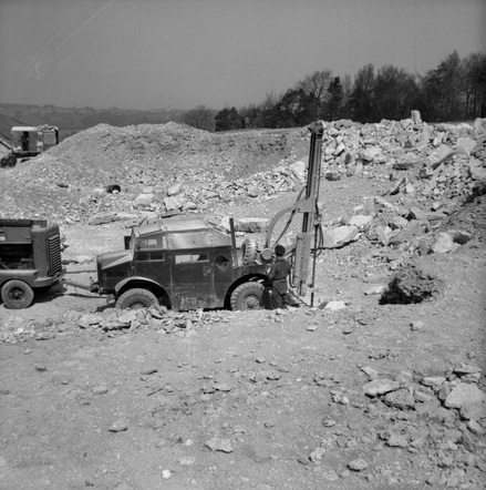
New Boxfield Quarry, 1961
The photos below show an excavator removing topsoil (left) and a driller excavating pieces of stone (right) at the start of a development for a new quarry at Boxfields in about 1961.
The photos below show an excavator removing topsoil (left) and a driller excavating pieces of stone (right) at the start of a development for a new quarry at Boxfields in about 1961.
|
|
Warning
The quarries are a source of danger and should not be entered without permission. We do not reveal the entrances and we ask everyone to exercise appropriate caution.
Can you add to this history? If so, please Contact us.
The quarries are a source of danger and should not be entered without permission. We do not reveal the entrances and we ask everyone to exercise appropriate caution.
Can you add to this history? If so, please Contact us.
References
[1] National Library of Scotland (which surprisingly has scanned images of the whole of the UK and is free) at http://maps.nls.uk/view/102347983
[2] Bath & Wilts Evening Chronicle, 28 August 1970
[3] The Evening Post, 11 April 1972
[4] Bath & Wilts Evening Chronicle, 29 January 1973 and 5 February 1973
[5] Bath & Wilts Evening Chronicle, 31 January 1973
[6] Western Daily Press, 31 January 1973