Box Aerial View Proposed by Richard Pinker May 2022
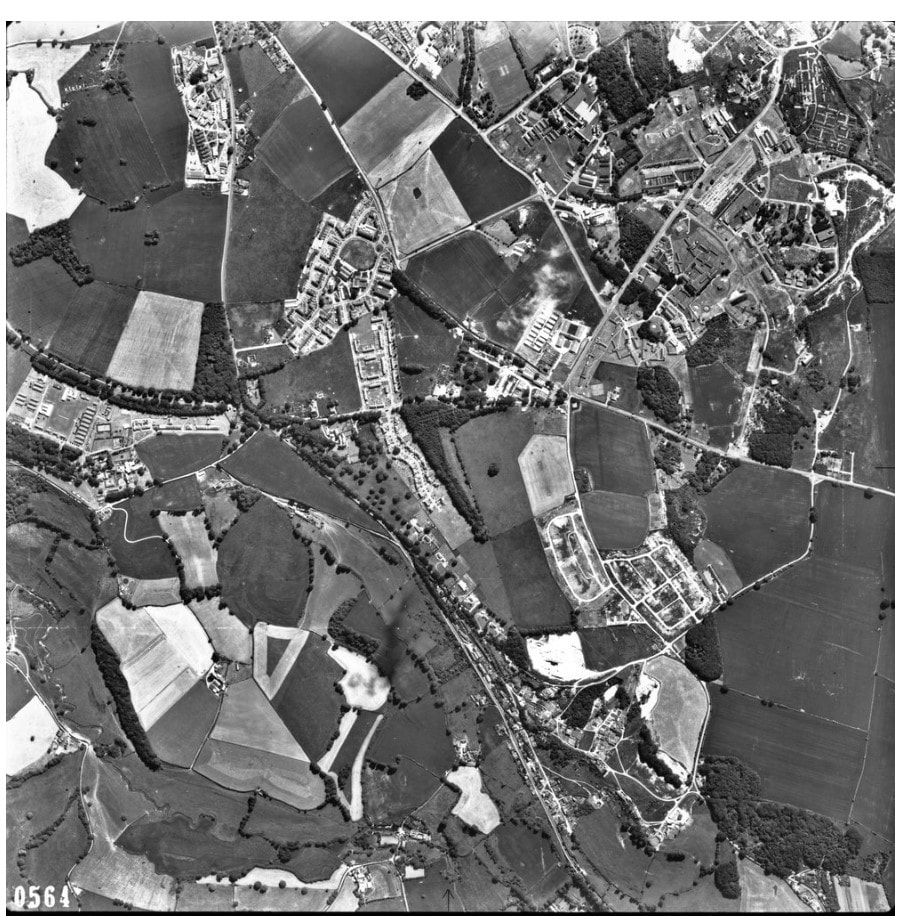
This amazing photograph shows Box Hill on 13 June 1967 referenced RAF_543_3859_F21_0564, courtesy Historic England Archive Images. The road running from the top of the photo to the right middle is the Bradford Road; the road from the Bradford Road in a half circle is White Innox Lane; and the road from the left middle to the bottom is the A4. This enables you to identify the Boxfields prefabricated bungalows in two separate estates: the square at Southlands, where Box Highlands School existed and the northern roads in a rectangle. You can also see the tunnel ventilation shafts and the New Hazelbury quarry. Many of the white areas are the disused quarry sites and you can just make out Tunnel Inn.
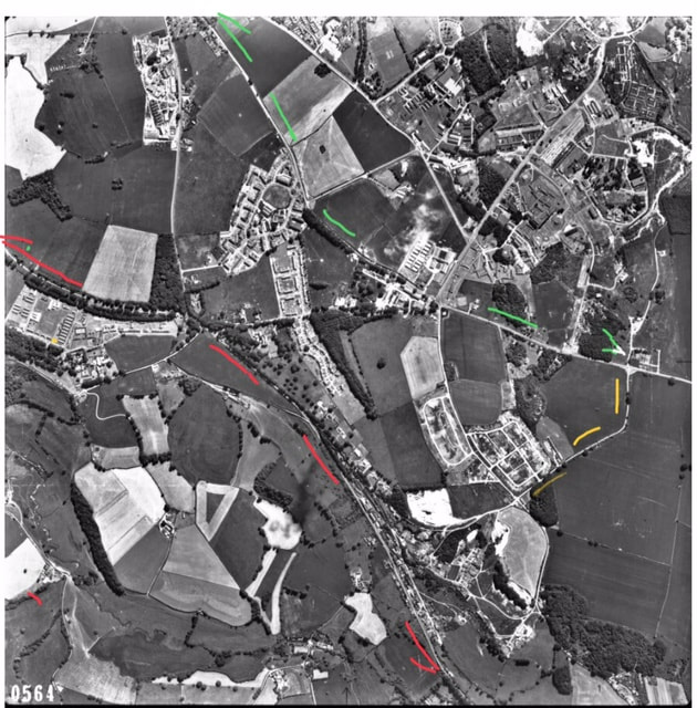
Green = Bradford Road; Red =A4; and Yellow = White Innox Lane